 |

|
|

|
Discovering MapPoint Map Printing CapabilitiesJohn Washenberger outlines a method for generating large area detailed map images by saving the map as a web page
I�ve always wanted to explore the capabilities of MapPoint 2002 for printing out large maps. I never got around to it until recently when I needed a good map of the area where I live, Bainbridge Island, WA. As you see, Chilly Hilly is fast approaching. The Chilly Hilly is a 33 mile organized bicycle ride around Bainbridge Island that draws a few thousand people each year (give or take a couple thousand depending on the weather!). For this event, we invite family, friends and friends of friends, and their relatives over to participate in the ride followed by a little celebration. One thing about the Chilly Hilly route is that it bypasses some of the most scenic (and most difficult) roads on the island. So each year, I offer up some alternatives to riders who are interested in going off the beaten path. Some want shorter routes; others want the �full meal deal� including the dreaded Toe Jam Hill. As you may have guessed by this point, I needed a map of the Island so that I could allow my guests to take a look at the alternatives. This led me to October edition of the newsletter published by MP2KMAG.com where I had seen a photo of a map measuring 30"x44" that was generated using MapPoint 2002 (View the photo here). Unfortunately, the news clip in the newsletter did not include information on how printing a map of this size was achieved. I started snooping around and learned that the �Print� feature was limited to printing only the display area of the map and the paper size offered by the printers connected to the machine from which MapPoint was being used. I have a 19� inch monitor and have never spent more than $200 on printer (actually $160 with the rebate). Things didn�t look good. But how did they print out that 30� x 44� map. Well, I took a closer look at the �File� menu and noticed the �Save as Web Page� menu item. This feature allows you to control the size of the generated map by entering the �Map size in pixels� height and width which can be maxed out at 3500 x 3500. I fooled around with this for a while and discovered that the detail was effected by the detail of the map displayed and the height and width entered in the �Save as Web Page� dialog. To help maximize the detail, I selected the highest resolution of my monitor (1600x1200) pixels. I then selected the area of interest using the �Select� feature on MapPoint�s �Navigation� toolbar and maximized the window followed by zooming in to get the best possible detail of the selected area Finally, I saved the map as a web page after setting the �Map size in pixels:� to 3500x3500. MapPoint saves the map to a specified folder in GIF format. Once I opened the GIF file, I noticed the detail was better than MapPoint had displayed on the screen.
Now I just needed a printer to print the map. To accomplish this, I copied the file to a floppy and headed off to Kinkos. Once there, I handed over the floppy and requested a printout. After reviewing the file, they presented me with the option of having a colored print generated for $100 or a black and white print for $4.00. Needless to say, this decision was easy to make and within a couple minutes I had a black and white copy of the Bainbridge Island map measuring 36� x 24� with enough detail to serve its purpose for mapping out alternative routes. 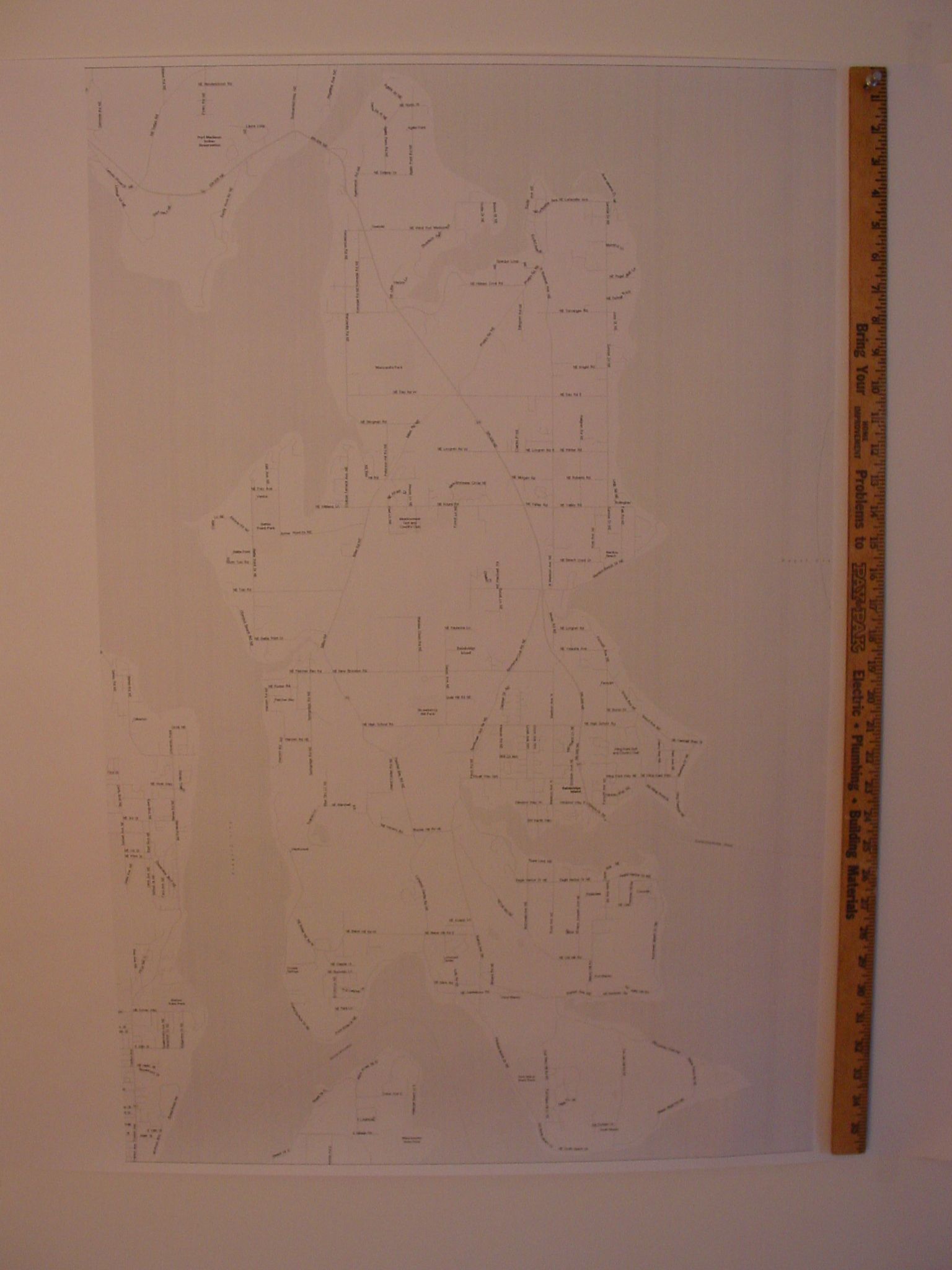 (click on the image to view the entire photo, 225k) March 10, 2003 Update: A color map is now available. John Washenberger used the large-format plotting services of Mattys Consulting. 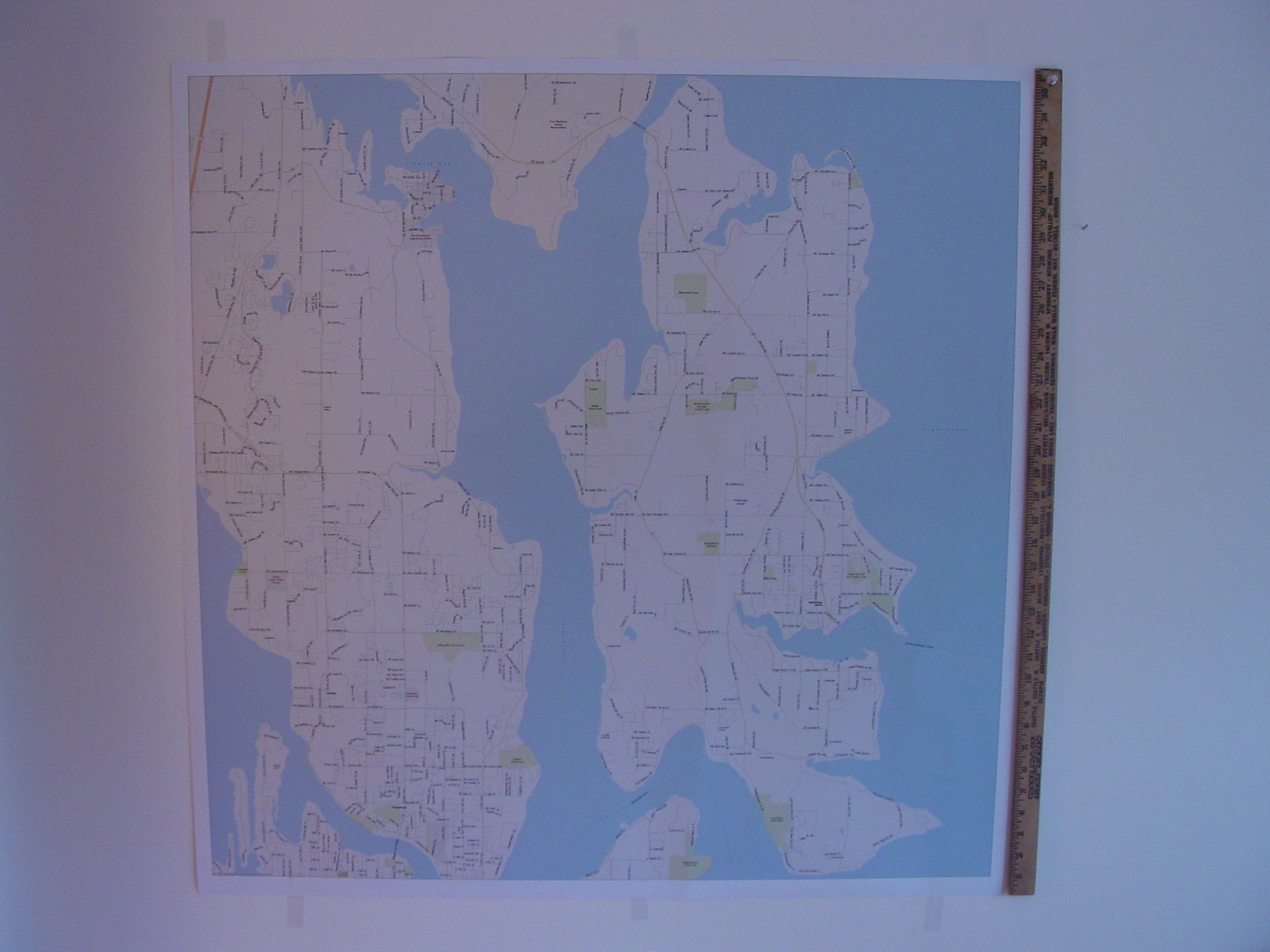 (click on the image to view the entire photo, 1,220k) Every time I look around a corner in MapPoint I find a tidbit of functionality that increases my appreciation of this application and enhances its value to me as a tool (I encourage you to read �MapPoint Review and Perspective� by Andrew Whitman for more on this subject). I would be very interested in hearing any other experiences people have had in printing maps using MapPoint.
Author: John Washenberger Email: jwash(AT)seadak.com URL: http://www.seadak.com John is a Software Development Consultant for SeaDak Solutions, Inc. located on Bainbridge Island, WA which specializes in developing Microsoft integrated office and database solutions.
|
|
||||||||||||||||||||||||||||||||||||||||||||||||||||||||||||||||||
|
|
||||||||||||||||||||||||||||||||||||||||||||||||||||||||||||||||||||


