MAPPOINT MAP GALLERY
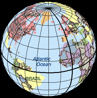
Parallels and Meridians Display in MapPoint 2002

(click on the image to view the full screenshot)
This globe view map was produced by a MapPoint 2002 COM add-in designed to display parallels and meridians at spacings of 15 degrees for any MapPoint 2002 map. Note that the Prime Meridian and the Equator are shown with a heavier weight line. The first time around, this was written as a stand alone .exe and took more than one minute to draw the entire grid on a Pentium III at 750 MHz. When changed into a COM add-in the time was reduced to less than 15 seconds. This clearly shows the speed advantage of a COM add-in running in-process with MapPoint 2002
Submitted by: Rich Born, Associate Professor, College of Business, Northern Illinois University

