MAPPOINT MAP GALLERY
PoleTrack Application Images
(click on the image to view the full screenshot)
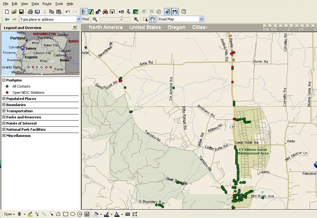
We have a product called PoleTrack that allows utility employees to collect field inspection data on a Pocket PC, upload it to a SQL Server database...", and use an ASP.net application to manage maintenance work, invoicing, joint-use and safety violations for all their poles and underground facilities. We use MapPoint to extract and analyze data from the database, such as the locations of safety violations and work activities. Essentially, we use MapPoint for several purposes:
- To identify patterns such as violations by location (Open Violations map)
- To create general maps of the utility's service territory (Poles by Tranmission and Distribution map--46,000 facilities displayed!)
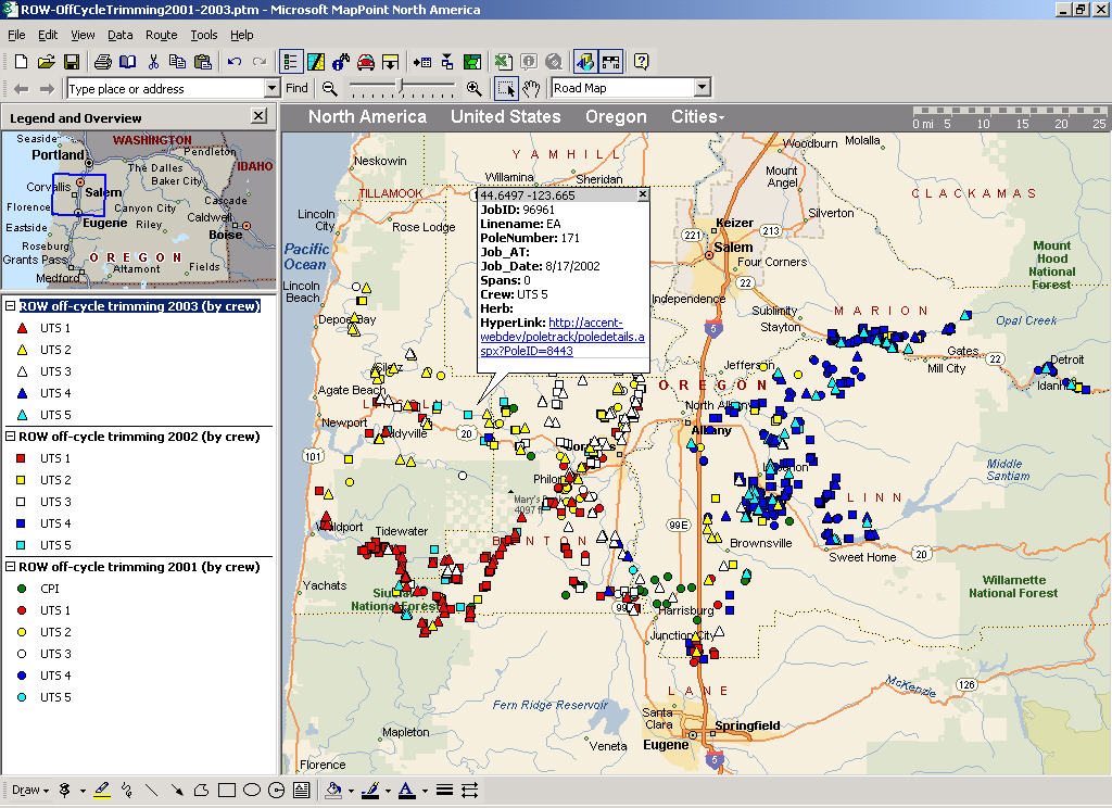
- To document history of work activities (Right-of-way Off-cycle Trimming map)
- To show driving directions to a pole or facility requiring maintenance work (particularly useful when communicating with another utility or regulatory agency)
- To create driving routes for dispatching purposes
Because PoleTrack is built in ASP.net, we were able to come up with a creative way to link MapPoint to the application via the HTTP string. For example, the Right-of-way Off-cycle Trimming map show an open dialog box with a hyperlink. If the user clicks on that hyperlink, it launches our PoleTrack application and automatically opens the record for that pole.
In the field, we use PoleTrack Mobile (on the Pocket PC) to collect GPS coordinates at the pole from a Bluetooth GPS unit. This data is then uploaded, along with the rest of the database, to the main SQL Server database back at the utility Operations Center. We're currently working on linking the PoleTrack Mobile database directly to Pocket Streets, instead of having to download everything from MapPoint back in the office.