FeatureWhat's New in MapPoint Web Service
3.5
The latest incarnation of the MapPoint
Web Service starts bringing South America into the fold with the inclusion
of data for major cities in Brazil. This is now the third continent on
which Microsoft is offering MapPoint. MapPoint desktop will users will
probably see this new South American data incorporated into either
MapPoint North America or MapPoint Europe rather than a third version
being introduced at least for the time being until there is enough South
American data for a stand-alone version.
As the MapPoint Web Service data is
updated more often and contains more current data than the desktop version
of MapPoint, the web service in turn slowly catches up to the desktop
product in terms of functionality. In this version, find along route or
Find Near Route functionality is added to the Find API, allowing
developers to incorporate this into their MapPoint Web Service
applications. One example I saw shows wi-fi spots within 10 miles of a
cross-country interstate highway trip. Also, the number of locations
returned by Find Nearby has been increased from 250 to 500 and the maximum
radius for proximity searches has doubled to 100 miles.
Two new image formats, PNG and WBMB, are
now supported natively aiding developers targeting Smartphone and Pocket
PC's.
The Customer Service Site has been given
a make-over. I don't have enough experience with it to give an adequate
review of what's better, but certainly allowing automated, scheduled
uploads of custom POI data rather than manual, interactive uploads has
obvious appeal. A sample application demonstrating its use is included in
the SDK.
EditorialMapPoint Web Service for
All
by Eric Frost, February 27, 2004
Since the introduction of the MapPoint
Web Service a couple years ago, I've seen several requests in various
forums about how MSDN subscribers get the MapPoint Web Service. An MSDN
subscription, as you may know, entitles the owner to obtain copies of
Microsoft operating systems and business and productivity software. At the
highest levels of the subscription (enterprise or universal?) virtually
all Microsoft software products (including MapPoint 2004) are included in
the subscription except Microsoft consumer software.
So a seemingly valid question to ask, and
one many MSDN subscribers have asked, is where do I "download" the
MapPoint Web Service or gain access to it? Of course the distribution
model for web services is quite different from traditional methods of
software distribution, and the MSDN method of distribution (monthly DVD
shipments and online download access) is not applicable to a web service
in which credentials are tightly guarded and monitored.
Up until now, MSDN subscribers are in the
same boat as the rest of us, if they want to explore and learn how to use
the MapPoint web service, they need to sign up for a 45-day evaluation
account.
As web services as a software medium
evolve, at some point Microsoft will have to make known how web services
fit into the MSDN scheme of things, should MSDN subscribers be given any
special rights or priveleges?
MP2Kmag has heard that one option that
has been considered is to give MSDN subscribers 1-year, limited
transaction accounts to the service, with possibly no
commercial/non-commercial restrictions on its use. Whether or not it will
happen or how the logistics might be handled, I do not know, but it would
certainly make the technology much more accessible and enticing to
Joe-developer.
Certainly it would be a smart move on
Microsoft's part (assuming the engineers are ready for the load and the
marginal costs are low) and it could do a lot to change the competitive
landscape for mapping web services. Microsoft has always fostered a close
relationship with the mainstream programmer, many of whom will not be
aware of MapQuest's Enterprise Solutions or for that matter even heard of
ESRI. In many shops the MapPoint Web Service may be the de facto - first
and only - mapping service considered for such solutions.
In any case, it does look like the coming
years will see an explosion in the use of location technology and
Microsoft's thrust with the MapPoint Web Service seems to be with mobile
devices (e.g. phones, Connected Car). I look forward to seeing what nifty
mobile location-based services are brought to market this decade.
Microsoft's moves with regard to MSDN and making the MapPoint Web Service
more accessible to mainstream programmers may factor into how quickly they
are developed.
ArticlesInvestigating the MapPoint Web Service 3.5 SDK
by Eric Frost February 27, 2004
We take a look at getting started with
the MapPoint Web Service including how to obtain an evaluation account,
set up your computer with the right software, and run the Core
Functionality samples both on your local computer and an ASP.NET web
server.
"I started playing the the MapPoint Web
Service SDK this month for what is now the third time in the couple of
years that the MapPoint Web Service (originally known as MapPoint .NET)
has been available.
"The marketing effort and support behind
the MapPoint Web Service has only seemed to increase over the years unlike
the MapPoint desktop product, and the sustained push by Microsoft gives
the impression this is a product that will only increase in
importance."
 Full
article text Full
article text  Discuss
this story
Discuss
this story
Determining
the Time Zone in MapPoint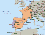
by Leon Schell, February 21, 2004
"A question that gets asked every once in a
while is whether it's possible to display time zones in MapPoint. Using
and experimenting with articles from John
Washenberger and Gilles
Kohl I have come up with the following solution.
"One way to get to the time zone
information is to loop through POI's in a way described by John.
Basically, you first determine the area you want to examine and then loop
through that area using a longitudinal (east to west) loop nested within a
latitudinal (south to north) loop. In the code example below, I will try
to get the time zone information for Portugal, Spain and France, using
latitudes ranging from 36 to 44 degrees N and longitudes ranging from 10
degrees W to 4 degrees E. Since looping through all POI's can be time
consuming, I decided to include only major airports - I think it is fair
to presume that every country or state you want to map at least has one
major airport." Full article
text
Discuss
this story
Submit an article
|