 |

|
|

|
MapPoint Review and PerspectiveMapPoint�. GIS System, Mapping package, or just a real business tool? Andrew Whittam shares his insights
For some years I have been working with MapInfo and after the usual baptism of fire in terms of trying to figure it out (with the help of the excellent MapInfo-list forum), I now consider my self a proficient and business orientated user. In my work as a freelance data analyst I always found it easy to get clients interested in the nuggets in their data by beginning a meeting with a large map showing things like� where their customers were, where the concentrations of their best customers were in relation to their stores. A map is such a fascinating picture and it surely paints many thousand customer, patient, employee, or member records. After the initial euphoria, the problem I always had was twofold: 1. The sheer cost of buying MapInfo (or Arcview) plus the cost of the
base mapping data
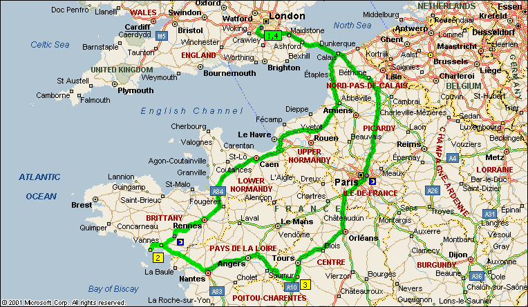
In some respects, those problems are opportunities for me, and that will continue to be the case. However, while many organisations can and do understand the insights provided from geographic analysis, they aren't usually willing to shell out finance and technical resource early on. So, sadly the interest in GIS wanes. Was there any light at the end of the tunnel? I first came across MapPoint a while ago with MapPoint 2000. I got it by accident. A demo version on the front of a magazine I bought wouldn't work. I emailed the editor and got a free full version by way of apology. It seemed a good deal, and certainly it was. For some time I'd wandered why Microsoft hadn't released any business mapping software, MapPoint 2000 was possibly the answer. I played around with it on and off for a while. It allowed for basic maps and the ability to import data and produce thematic (shaded) maps. What it lacked was a drivetime facility and anything but relatively basic UK data and the ability to customise it with VBA. At the time it didn't seem interesting enough to invest time investigating and evaluating more fully. In the same vein, I didn't hear too much about it in the news groups or from other GIS professionals. Possibly this was because it lacked the usual glitzy marketing support from Microsoft. Then last year along came MapPoint 2002� again it seemed interesting. This time though there was a comprehensive drivetime module (certainly better than MapInfo's), the ability to customise using VB, data across Europe, better integration with MS Office and loads of tools that I would usually only expect to find in a "proper" GIS package. Interesting� so interesting I invested �170 of my hard earned income in it� immediately� without waiting for the evaluation to expire! I could now do all sorts of things: * Plan a route for my holiday to France
 These were just tasks on a personal level. To think what I might be able to do professionally in my freelance role� I might even address the cost and resource issue of using the "real" GIS solutions. So, having done all those "play around" things one does on a rainy Saturday morning (we have them in the UK), and having realised this was more than just a play piece of software, I started to realise that MapPoint was a tool I could use in my work. Looking through past GIS projects (or GI projects as is the current politically correct term for fiddling with Postcodes and maps) I realised that around 80% of my work didn't require anything sophisticated. More importantly for my clients and a new breed of desktop analysts (I'll come to them shortly), the costs of producing maps would decrease significantly. With any GI project the first task is to understand the business questions. Typically they run along the lines of: * Where are my customers� where are my best customers� where
are my dealers in relation to the customers who haven't spent in the
last three months
It's relatively simple stuff, it earns me a living and it's satisfying to see the looks on the faces as they pour over the map from different sides of the table. So, we now have a Microsoft tool, which presents data in another business dimension. It's good, it's cheap and� it works!  The effect on the GI market isn't just about people producing maps at a fraction of the cost. What will emerge is a new strata of business analyst - desktop analysts who have a basic understanding of geography, whether Postcode or their own territories. As long as they are data literate, as most decision makers are these days with products like Excel, then MapPoint can be as much a familiar tool as Excel... well almost. These people make business decisions; they don't sit in IT departments. As I write this I hear the virtual mutterings of MapInfo and ArcInfo technologists berating MapPoints simplicity. "It won't do... XYZ projection", "it's not a serious GI tool" - these things have been said to my face when I do my "...have you used MapPoint 2002... it's great!". I think that's where they are wrong. It does pretty much all of what I think my clients will want. For most who have never used a layer control or written SQL they won't miss these features. They want the basic questions answering. It's simple Pareto - 80% of the decisions can be made from 20% of the data effort. I agree that sadly the other 80% of the data effort gets left behind, they have made their decisions. With respect to most of these new desktop GI analysts, they probably don't know what mapping projections are... more importantly, they don't need to know. This breed of business GI consumer just wants to have the information to make decisions. I guess the GI stalwarts are more concerned about their turf being invaded, both from a purity and a business angle. This doesn't have to be the case though. The GI market is nowhere near saturation. Giving the desktop analyst the facility to answer the basic where questions on his/her own, almost always prompts further questions. These in turn require heavyweight tools and solutions to provide answers. I am finding that questions are being asked that wouldn't have been asked without the use of tools like MapPoint. It's not just in the GI area. Much of my work is centred around desktop data analysis. Giving clients their data in customised, often interactive, Excel solutions always brings about meetings where more sophisticated, interesting and even sometimes revenue bearing solutions are required! MapPoint isn't all things to all people, but without a doubt it is a valuable entry tool into serious GI decision making. With a little thought, it can have knock on benefits for the serious GI practitioner. In any case I'm sure Bill Gates has thought this all through. Where I can see a geographical angle in my client's data I will certainly be showing how MapPoint can help to aide decision-making. When I tell them the cost and how they can explore their data geographically, I expect they will be impressed.
Author: Andrew Whittam Email: andrew(AT)jmdata.co.uk URL: http://www.jmdata.co.uk Andrew is a freelance data analyst with a specialist area of interest in Mapping and Geographical Analysis. He has 15 years experience in the data side of Market Analysis, Market Research and Database Marketing. His interest range from historical maps to furniture design. He lives with his family in South West London (UK).
|
|
||||||||||||||||||||||||||||||||||||||||||||||||||||||||||||||||||
|
|
||||||||||||||||||||||||||||||||||||||||||||||||||||||||||||||||||||


