 |

|
|

|
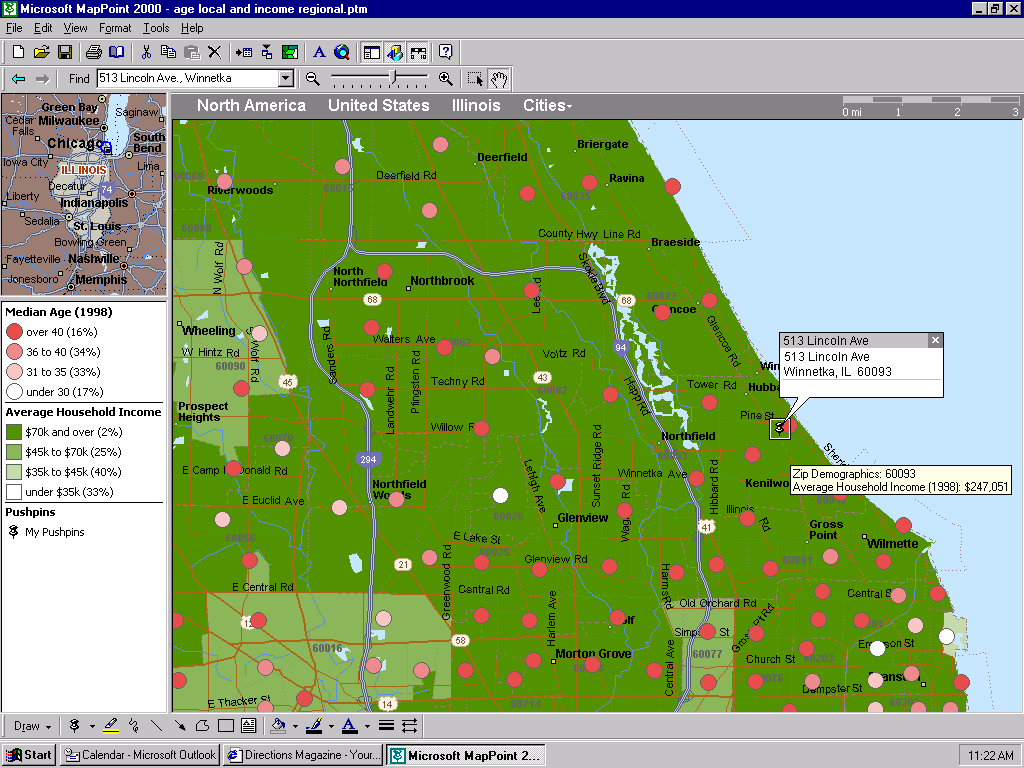
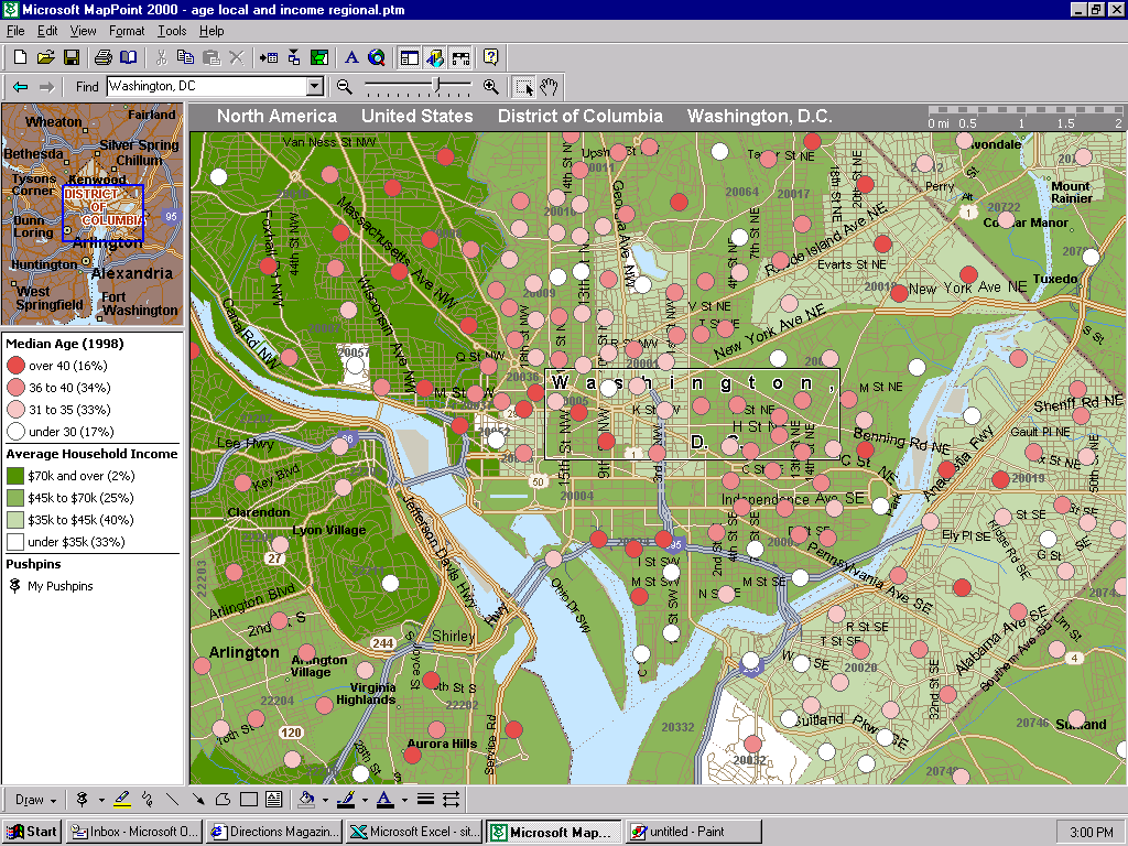
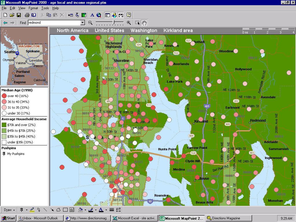 Here we display two data variables simultaneously, this time at a fairly local level. Income is shown at the zip code level, using greens to shade the zip code; the population's median age is indicated by the color of the little dots. One advantage of using the colored dots with census tracts is that the density of the dots themselves gives an indication of population density; thus we really get three variables being mapped. I also adjusted the legend so that more information is delivered with less text. Each legend entry gives the value of its respective bin, and the portion of the total contained in that bin. Once this map is built, it's built for the country! You can see the data for any other locale by using the "Find" tool. Here is the "same" map for two other locales:
|
|
||||||||||||||||||||||||||||||||||||||||||||||||||||||||||||||||||
|
|
||||||||||||||||||||||||||||||||||||||||||||||||||||||||||||||||||||


