|

|
|

|
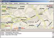
Virtual Earth Application on MSNBC Shows Katrina Devastation
People can potentially view the damage to their homes. The data may also assist insurers in verifying claims and local agencies in determining which areas were hardest hit so they can prioritize cleanup. The application is here - http://msnbc.msn.com/apps/ve/katrina.htm.
advertisement
|
|
||||||||||||||||||||||||||||||||||||||||||||||||||||||||||||||||||||
|
|
||||||||||||||||||||||||||||||||||||||||||||||||||||||||||||||||||||||


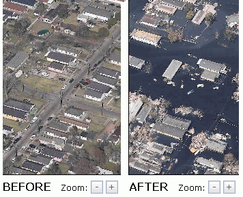 A new MSNBC feature shows Katrina hurricane damage using MSN Virtual Earth. Aerial photos from helicopters depict before and after pictures of large swaths of the affected area.