


MapPoint News
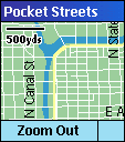 Microsoft Pocket Streets for Smartphone
From Geekzone
– "Pocket Streets for Smartphone offers great map guide functionality
right on your Smartphone. Locate addresses, intersections and points of
interest or customize locations by inserting your own pushpins.
Download maps of cities in the US, Canada and Western Europe from the
Pocket Streets web site, or create your own maps using Microsoft
desktop applications MapPoint, Streets & Trips or AutoRoute. Once
your maps have been synced to your Smartphone you can access them when
you need them most, when you are on the go."
Microsoft Launches MapPoint Location Server
From Software Development Times –
"In an effort to increase enterprise adoption of its mapping
technology, Microsoft Corp. announced last month MapPoint Location
Server (MLS), an extension of the MapPoint Web Service the company
debuted in April 2002 that enables developers to incorporate real-time
location data from cell phones into applications.
Storm Source to Release GPS.NET for the PocketPC
StormSource Software has announced that it will be releasing its “GPS.NET” software for the PocketPC. GPS.NET is a component which assists software developers with writing GPS-enabled applications. The component, currently available for Visual Studio and Visual Studio.NET, boasts over 80 methods in 20 classes in a 100Kb assembly to perform virtually any GPS-related task, from calculating the distance to any point on Earth, to writing applications which require highly-precise positional measurements.
Software Review: Pocket Streets for MS Smartphone
From msmobiles.com – "Pocket
Streets has been available for Pocket PC for quite some time, but most
MS Smarphone users have no prior experience with the Pocket PC
platform."
Chandu Thota's BlogMap Goes Global
"I have been getting emails and
comments that the BlogMap should really be global to support blogs from
countries other than USA. Now you can submit rss/atom feeds from any
country to my BlogMap."
MapPoint Developer Channel on DevX
Microsoft has launched a "Vendor
Development Portal" on DevX. More information on DevX Vendor
Development Portals can be found in the Advertising Info
section of the DevX web site.
Symbian Falters in Battle With Microsoft
From the Register – "The battle
between Nokia and Microsoft to dominate the mobile operating system was
thrown into sharp relief this week as both upgraded their software
platforms."
Submit your news
Microsoft and Technology News
 Microsoft's
Midlife Crisis
Microsoft's
Midlife CrisisFrom BusinessWeek – "Threats
abound: Linux. European trustbusters. Key product delays. Can Gates
& Co. restore growth? Would you invest your hard-earned dollars in
a company like this? Its revenues soared an average of 36% through the
1990s, but now it's heading into miserly single-digit growth. It has
long been a powerful engine fueled by major updates of its products,
yet the next major one, an unprecedented five years in the making,
isn't expected until 2006. The company hasn't made much headway in
newer, promising markets. And its share price is stuck exactly where it
was in mid-1998."
Microsoft's Innovation: 2004 and Beyond
From The Washington Post
(registration
required) –
"We are really creating what I think is an "ecology" of intelligent
computing devices that can make everyday objects much smarter and able
to perform their functions. A lot of the advances on the cell phone
front involve tying those devices into the broader computing
environment -- the Internet, your PC, backend databases, your other
devices."
Speech! Microsoft Launches New Server
From Software Development Times –
"As anticipated, Microsoft Corp. launched Speech Server 2004 at the
combined VSLive, Microsoft Mobile Developer Conference and Avios
SpeechTEK events held here last month. Bill Gates demonstrated how
Windows-based mobile devices can work with Speech Server 2004 and
MapPoint Location Server to provide an integrated system for developing
wireless applications."
From CNET TechNews – "We're
focusing more on research than ever. We're building the technology that
will enable computers to see, listen, speak and learn so people can
interact with them as naturally as they interact with other people." --
Bill Gates, chairman and chief software architect at Microsoft. In
2003, Microsoft spent over (all figures US) $4.6 billion on research
and development. For a company that had revenues of $32.1 billion in
the corresponding period, this is an impressive figure and to put in
perspective, they spent $6.5 billion on sales and marketing during the
same period. Clearly, R&D is important to the company.
GIS,
Location Technology and Where they Fit in the IT Value Chain
From Directions Magazine – "GIS and
location technology is not an industry. We are a technology sector.
Writing in Geospatial Solutions Magazine last month, Frederic
Corle, president of the Spatial Technologies Industry Association,
continually referred to the “spatial technology industry.” If we
continue to refer to ourselves like this, we'll remain a narrow segment
of the IT marketplace. Spatial technology is comprised of a group of
companies that sit within the value chain of the information technology
(IT) infrastructure, just as databases and spreadsheets do."
McDonald's Chooses Wayport for New Wi-Fi
From Yahoo! News – "McDonald's Corp. has chosen Wayport Inc. to provide wireless Internet service in dining rooms and drive-through windows at several thousand of its U.S. restaurants. Wayport officials called it the biggest single deal yet to create wireless Internet "hot spots." They said the familiar golden arches will offer a reliable place for road-weary workers to download e-mail or surf the Internet.