|
 Welcome
to another issue of
the MP2Kmag Update. Hope your Spring is going well! In this issue we share information about the upcoming Location Intelligence for Enterprise USA conference here in Chicago. At least two speakers from Microsoft will be participating. Welcome
to another issue of
the MP2Kmag Update. Hope your Spring is going well! In this issue we share information about the upcoming Location Intelligence for Enterprise USA conference here in Chicago. At least two speakers from Microsoft will be participating. Included in this issue are five new articles published since our last newsletter, four of them exploring and demonstrating how to effectively use the sometimes frustrating, but very powerful, DisplayDataMap method. The remaining article demonstrates how to determine the three closest stores to each customer using MPMileCharter. MP2K Magazine is your source for independent news and information about MapPoint and other Microsoft mapping technologies and we also host the popular web forum for MapPoint users and developers (www.mapforums.com). This Issue's Contents at a Glance - Location Intelligence for Enterprise USA, June 14-15, Chicago - Recent Forum Highlights - MapForums Programming Challenge! - April 2012 POI Megafile from the Streets & Trips Team Blog - Get Published in MP2K Magazine Articles - MPMileCharter Example: Finding only the Three Closest Stores to each Customer - Using ImportData and DisplayDataMap Part 1 - The ImportData Method - Using ImportData and DisplayDataMap Part 2 - Introducing DisplayDataMap - Using ImportData and DisplayDataMap Part 3 - DisplayDataMap Parameters - Using Python to call ImportData and DisplayDataMap Happy Mapping and please forward this newsletter to anyone who would be interested! |
|||||||||
FeaturesLocation Intelligence for Enterprise USA Location
Intelligence for Enterprise USA is just two months away and aims to be
the premier meeting place for anyone who's anyone in the geospatial,
GIS and Location Intelligence industry. Location
Intelligence for Enterprise USA is just two months away and aims to be
the premier meeting place for anyone who's anyone in the geospatial,
GIS and Location Intelligence industry.This year's agenda is geared towards the end user and gives a unique opportunity to address the major problem plaguing the Location Intelligence ecosystem - Communicating the value of Location Intelligence to big businesses and securing profitable business. Speakers from Fedex, Walgreens, IBM, Bing, Thomson Reuters, T-Mobile, Microsoft Azure, Jones Lang LaSalle, Dave and Busters, Neilsen and many more will be presenting. They'll be discussing the success and challenges of implementing a Location Intelligence solution.  Microsoft
speakers include Beny Rubinstien, Sr. Specialist Business Development
Manager & Marketing Lead – Cloud Computing, Microsoft Azure and
Eric Waldman, North American Sales Manager, Bing Local. Having started
with a BA in Environmental Design from UC Berkeley, Eric Waldman has
25+ years of experience in GIS & Mapping industry with a strong
background in Local Search, Remote Sensing, 3D Visualization and Cloud
Mapping Services. His background includes: Managing
Sales/Marketing at Hitachi Software Engineering, Western Regional
Manager at Space Imaging, Vice President Photon Research, Sr Director
GlobeXplorer, Geo-Spatial Specialist with the Bing Maps team and
currently North American Sales Manager for Bing Local in Microsoft Corp. Microsoft
speakers include Beny Rubinstien, Sr. Specialist Business Development
Manager & Marketing Lead – Cloud Computing, Microsoft Azure and
Eric Waldman, North American Sales Manager, Bing Local. Having started
with a BA in Environmental Design from UC Berkeley, Eric Waldman has
25+ years of experience in GIS & Mapping industry with a strong
background in Local Search, Remote Sensing, 3D Visualization and Cloud
Mapping Services. His background includes: Managing
Sales/Marketing at Hitachi Software Engineering, Western Regional
Manager at Space Imaging, Vice President Photon Research, Sr Director
GlobeXplorer, Geo-Spatial Specialist with the Bing Maps team and
currently North American Sales Manager for Bing Local in Microsoft Corp.For more information go to: http://www.thewherebusiness.com Recent Forum Highlights  Here
are some higlights from MapForums over the last few months. If you are
not familiar with it, MapForums is an active community of MapPoint and
other mapping software developers and users. If you are heavy or even
occasional user of MapPoint and other mapping software, it would be
worth your time to Introduce Yourself
and post your nagging questions, share solutions, and get connected
with others in your industry or using MapPoint in similar ways. Here
are some higlights from MapForums over the last few months. If you are
not familiar with it, MapForums is an active community of MapPoint and
other mapping software developers and users. If you are heavy or even
occasional user of MapPoint and other mapping software, it would be
worth your time to Introduce Yourself
and post your nagging questions, share solutions, and get connected
with others in your industry or using MapPoint in similar ways.
This may require some fairly advanced Windows programming knowledge if it is indeed at all possible, but perhaps I am mistaken. Take a look at this thread here -- Add Waypoints Starts to get Really Slow. Is it possible to add a whole pushpinset to a route with one command such as you can do with the normal MapPoint interface by right-clicking on a dataset in the Legend and selecting "Add pushpins as stops"? Take a look at these past articles which show how to automate things in MapPoint beyond what the regular API exposes: Extending the MapPoint ActiveX Control Part 1 and Part 2. I think the same sort of techniques may be employed here, although with the added complication of needing to send a parameter to specify which pushpinset is to be added to the route. The first person to demonstrate a working solution will receive their choice: a copy of Programming MapPoint in .NET ($50 value) or a $25 Amazon gift certificate and everyone who contributes or submits a solution will be given a shout-out here next month. Please post in the thread above or write to us at website@mp2kmag.com. Good luck! April 2012 Megafile from the Streets & Trips Team Blog The Streets & Trips Team Blog at http://msstreets.com has been compiling points of interest (POI) for Streets & Trips that can also be easily imported into MapPoint. The POI "Mega Files" which contain the collections below and many other datasets can be downloaded from LaptopGPSWorld here. To save our readers some steps we've converted the most recent POI Mega File for North America to MapPoint 2011. Let us know if you have any trouble importing the European POI Mega File from AutoRoute to MapPoint 2011 and we'd be glad to help.
Click on the screenshots above to download and view more information about each dataset. Discuss this topic and share tips on other datasets and free data sources for MapPoint in the forums.  Get Published in MP2K Magazine Get Published in MP2K MagazineIf you have a MapPoint presentation, neat programming technique, or would simply like to share the ways in which you are using MapPoint technology or any other ideas, contact us to discuss how we can turn your knowledge into an article and share your experience with the rest of the MapPoint community of users and developers. Thanks to Marvin Hlavac for allowing us to use the picture on the right of his Maltese puppy eating from the MapPoint mug. |
|||||||||
|
|||||||||
Articles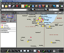 MPMileCharter Example: Finding only the Three Closest Stores to each Customer MPMileCharter Example: Finding only the Three Closest Stores to each Customer
Read Using MPMileCharter to create Mileage Charts with Microsoft MapPoint for an Introduction to MPMileCharter. "MPMileCharter comes with two license levels. The ‘Basic’ level includes most of MPMileCharter’s features and supports all of MapPoint’s route options. The ‘Professional’ license adds the ability to pause and restart processing runs (useful if your PC has to be restarted or switched off during a processing run); and the ability to only report the closest destinations. This latter feature is very powerful. Not only does it simplify the output by having the option to sort the destinations closest first, but MPMileCharter is clever enough to know when routes have no chance of being amongst the closest. It can safely skip these route calculations, resulting in huge speedups on large processing runs." "This example demonstrates how to use MPMileCharter to report the route distances from each customer to the three closest stores, ie. to find the three closest stores for each customer. The demonstration map can be found in the MPMileCharter examples file." Using ImportData and DisplayDataMap Part 1 - The ImportData Method Richard Marsden wrote this three part series on using the ImportData and DisplayData methods. "Some of the most complex and difficult to use methods in MapPoint’s programming interface (API) are those that import data and plot it." "Data importing is generally not too difficult, but ideally you should know what the input data looks like beforehand. This is in contrast to the user interface (“Data Import Wizard”) which lets you select data columns and assign them interactively." 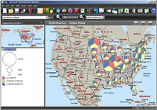 Using ImportData and DisplayDataMap Part 2 - Introducing DisplayDataMap Using ImportData and DisplayDataMap Part 2 - Introducing DisplayDataMapDisplayDataMap is where things can become more difficult. This method is used to display a dataset. "It is a complicated method with lots of parameters. It is easy to make a mistake with the parameters, and all parameter errors result in an un-informative “The parameter is incorrect” error. It is therefore recommended that you start with a working example (e.g. from this article), and adjust it step-by-step until it does what you require. Diagnostics such as the field loop in the above code sample, can also help." "The following code samples can all be inserted in the sample above where the comment “(data plotting code goes here)” appears. Before describing all the parameters, let’s start with an example. The following code plots the sales data as Sized Pie Charts..." Using ImportData and DisplayDataMap Part 3 - DisplayDataMap Parameters In this article, Richard Marsden puts it all together and explains the DisplayDataMap in detail. 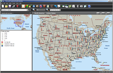 "DisplayDataMap
has a lot of parameters, and here they are in order: DataMapType,
DataField, ShowDataBy, CombineDataBy, DataRangeType, DataRangeOrder,
ColorScheme, DataRangeCount, ArrayOfCustomValues, ArrayOfCustomNames,
DivideByField, ArrayOfDataFieldLabels, and ArrayOfPushpinSymbols." "DisplayDataMap
has a lot of parameters, and here they are in order: DataMapType,
DataField, ShowDataBy, CombineDataBy, DataRangeType, DataRangeOrder,
ColorScheme, DataRangeCount, ArrayOfCustomValues, ArrayOfCustomNames,
DivideByField, ArrayOfDataFieldLabels, and ArrayOfPushpinSymbols."Using Python to call ImportData and DisplayDataMap This article is an addendum to the previous three-part article on using ImportData and DisplayDataMap. As the title indicates, this articles contains code and examples in Python for using the ImportData and DisplayDataMap methods. "This article follows on from my recent articles about using MapPoint’s ImportData and DisplayDataMap methods. It demonstrates how to use these methods from a non-Microsoft language that only supports COM as an extension and not an integral part of the language and libraries." "I will assume that you are familiar with the basics of calling MapPoint from Python using win32com (Using Python to Control MapPoint, Part 1 and Part 2). The samples in this article use MapPoint 2010 North America, Python 2.7, and the IDLE Python IDE. The samples use the same modified sample data used in the previous ImportData article." |
|||||||||
|
|
|||||||||
| Look forward to upcoming issues in which we focus on
recent MapPoint and Bing Maps news and share forum highlights. Previous issues of the MP2Kmag Update are available in
the newsletter archive. |
| Copyright 1999-2012 MP2K Magazine |
Please forward this newsletter to anyone who would be interested!


