Welcome
to another issue
of the MP2Kmag
Update. At the top of the news, late last month
Microsoft released more details and made
an official
announcement of the new MapPoint
Fleet Edition product.
MP2K Magazine is your source for independent
news and information about MapPoint
technologies and products and is home to the popular web forum for
MapPoint users and developers. This month we feature the first part of
an article from Sergey
Kostrov on
Automating
MapPoint
with C/C++. The second and final part of Richard Marsden's
popular article on mapping earthquake data is also included in this
issue as well as another short article from Richard outlining the new
symbols in MapPoint 2004.
One interesting note: in a period when most articles that appeared in
the press about MapPoint related a routing
glitch in Norway, there was one
good front page article in the Wall Street Journal which
mentioned MapPoint. The article
featured a quote from the new
MapPoint general manager
and was later syndicated in the Seattle Times and can be read
without a subscription.
Just earlier this week, we posted the third in our series of Excel /
MapPoint tutorials to the E-mail Discussion List and it is also now
posted in the newsletter archives. The fourth tutorial will appear in
another special edition shortly.
This Issue's Contents at a Glance
- features:
Third Installment of MapPoint Tutorial Posted in Newsletter Archives
- articles:
MapPoint Automation with C/C++, Mapping Earthquake Data, MapPoint 2002
and 2004 Symbols
- news:
Virtual Earth Proposal,
MapPoint Group Job Openings, MileCharter v1.2,
Locarta's Dashboard v3.1, TerraViewer for MapPoint
- forum:
Forum Highlights, Recognition of Active Participants, Over 10,500 posts
and Over 1,800 Registered Users
Happy Mapping and please forward this newsletter to anyone who would be
interested!
|
|
advertisement
|
|
 Make
MapPoint Work Harder for You Make
MapPoint Work Harder for You
Extend
MapPoint’s functionality. Add new data layers and menu items.
Get
expert technical assistance and training. Develop more robust
applications. SpatialPoint is staffed with MapPoint and spatial
technology experts. We’ve built our business helping
customers
make the most of MapPoint platforms. From MapPoint 2004 to MapPoint Web
Service, from locator applications to decision-support, we’re
your source for all matters MapPoint.
Visit www.spatialpoint.com
or call toll-free
866.846.5900.
|
|
|
Features
MapPoint
/ Excel Tutorials
The third installment of the MapPoint / Excel VBA demonstration was
recently published in a special edition that was sent to the E-mail
Discussion List and posted
in the newsletter archives.
In the interest of getting this newsletter out on a timely basis, I
decided to let the fourth installment of the MapPoint/Excel tutorial
gel a bit more. In any case, when I do publish it the tutorial will be
announced in the Email Discussion List and will be posted in the
archives. Stay tuned and thanks for your patience.
 Write for MP2K
Magazine
in 2005 Write for MP2K
Magazine
in 2005
If you have a MapPoint presentation, neat programming technique, or
would simply like to share the ways in which you are using MapPoint
technology or any other ideas, contact us to discuss how we can turn
your knowledge into
an article and share your experience with the rest of the MapPoint
community of users and developers.
Writers often plug their consulting service or other business interest
through their bio which appears at the bottom of the article. Others do
it for the Large MapPoint Mug (see right!). Whatever the
reason, it is
rewarding to share and take credit for the knowledge you share with the
rest of the community.
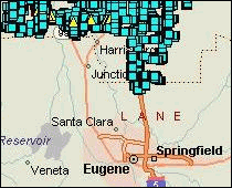
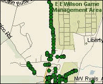
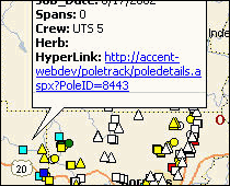
PoleTrack Application
Images
Dave Chaney submitted this set of
screenshots for our MapPoint Gallery.
"We have a product called PoleTrack that allows utility employees to
collect field inspection data on a Pocket PC, upload it to a SQL Server
database..., and use an ASP.net application to manage maintenance work,
invoicing, joint-use and safety violations for all their poles and
underground facilities. We use MapPoint to extract and analyze data
from the database, such as the locations of safety violations and work
activities."
|
|
advertisement
|
Articles
 MapPoint Automation With C/C++ -
Part I
MapPoint Automation With C/C++ -
Part I
This
is the first of three articles by Sergey Kostrov on automating MapPoint
Automation with C/C++ starting with a simple C/C++ application.
"As a C++ software developer I’m very surprised by the lack
of documentation from Microsoft about MapPoint Automation with C/C++.
It looks like Microsoft wants to “move” everybody
to the “.NET Universe” and completely ignores some
reality of the world when some C++ programmers don’t want to
give up…
On MP2Kmag there are already a couple of articles related with
automation of MapPoint from an application written in C++. In Part 1 of
my article I would like to demonstrate what should be done to
initialize MapPoint and then how to use MapPoint’s COM API."
 Full
article text
Full
article text  Discuss
this story
Discuss
this story
 Mapping Recent Earthquake Data
This
is the second installment of Richard Marsden's two-part article on
mapping earthquake data. In this part, Richard shows how to massage
USGS data in Excel for importing into MapPoint and depict earthquakes
as point data.
"Compared to the first part of the article, depicting the recent
earthquake data is much easier to plot and only requires Excel to
massage the data into a usable form for the MapPoint Data Import
Wizard.
The
recent earthquake data for California can be obtained from the USGS at:
http://quake.usgs.gov/recenteqs/Quakes/quakes0.htm."
Full
article text
Discuss
this story
 MapPoint
2004 Symbols MapPoint
2004 Symbols
Richard
Marsden assembled this guide to MapPoint 2002 symbols and the new
additional symbols found in MapPoint 2004.
Based
on Microsoft documentation with the addition of the new MapPoint 2004
symbols.
Full
article text
Discuss
this story
Submit an article
for publication and
receive a free Large
MapPoint Mug!
MapPoint
News
Bill Gates Considers Virtual
Earth Proposal During
Think Week
Yesterday the Wall
Street Journal ran an article on
Bill Gate's twice-yearly retreat known as "Think Week" during which
time he considered a proposal from the MapPoint Group entitled "Virtual
Earth".
MapPoint Fleet Edition 2004
Microsoft
Corp.’s MapPoint Business Unit recently announced MapPoint
Fleet
Edition 2004, providing new licensing options for customers who locate,
track and manage their fleets with MapPoint 2004.
Microsoft
Offers Partners New MapPoint License Option
From The Channel Insider
- "Microsoft has acceded to partners' requests to provide more
reasonable licensing options for MapPoint, a mapping software product
now being tweaked by some integrators to create custom logistics
applications for enterprises and SMBs that run their own fleets of cars
or trucks."
Stephen
Lawler has taken
on the role of General Manager of the MapPoint Business Unit. As
General Manager, Stephen oversees the worldwide development,
localization, and marketing of Microsoft’s consumer and
business
mapping software.
MapPoint Group Job Openings
The
MapPoint Group is
hiring. Openings are listed on their careers page in both Lebanon, NH
and Redmond, WA and include Product Manager, Business Development,
Software Development Engineers and Test Engineer, and Program Manager.
MapPoint
Web Service Enhancements
A
number of enhancements
were made to the MapPoint Web Service since MWS 3.5 was launched in
March, 2004 including both data updates as well as API changes.
The
Denver-based startup
demonstrated Data2Map, a application using Microsoft MapPoint 2004 as
the mapping system for managing a geospatial features. The company
highlighted their experience in implementing the application for a
large truck rental company.
Corporate Express Canada,
Cardinal Couriers and
Orkin Manage Fleets with MapPoint
According
to a recent
article in ENT News, Corporate Express Canada, Cardinal Couriers, and
Orkin are among those managing fleets with MapPoint technology and
third party integration.
Iteration2
Announces Appointment as a Managed Microsoft MapPoint Partner
"Microsoft
Gold Certified
Partner Iteration2 Extends Functionality of Field Service Application
(POA) with Integrated MapPoint Capabilities."
MSN
Maps & Directions Site Update
"MSN Maps &
Directions has updated its free, online
digital mapping service with a new set of innovative features and
services. Hallmarks of MSN Maps & Directions have always been
its
expansive global coverage, easy to use service and customizable maps."
Product Announcements
Locarta
Announces Dashboard 3.1 For MapPoint Fleet Edition
Locarta Technologies recently announced the Locarta Dashboard 3.1
software program for MapPoint Fleet Edition 2004. With the latest in
vehicle location technology, the Locarta vehicle tracking system
utilizes MapPoint as the map display for showing where your vehicles
are located any given moment.
Mapping Solutions releases
TerraViewer for MapPoint
Mapping Solutions
recently announced the release of
their latest product, TerraViewer for MapPoint. With a high speed
Internet connection, TerraViewer brings imagery from the United States
Geological Survey (USGS) into Microsoft MapPoint as a dynamic overlay
as the map is panned and zoomed.
Winwaed
Software Technology Release MileCharter v1.2
"MileCharter quickly and efficiently calculates mileage tables using
Microsoft MapPoint. v1.2 adds support for rate tables and mileage
charts that span multiple spreadsheets. Rate tables allow a flexible
range of cost calculations. Use your existing cost schedule, instead of
trying to adapt someone else's."
MapLinX
Pro - Visualize, Analyze, Communicate Info on a Map
MapLinX
has a MapPoint
tool add-in which they claim is a powerful and feature-packed add-on
query management tool that works seamlessly with Microsoft MapPoint
2004.
Run
Many GPS Applications Using One GPS
Franson
Technology
recently released Franson GpsGate, a Windows and PocketPC utility that
lets you run many GPS applications using a single GPS. You can create
any number of virtual serial ports, simulate a GPS, and log and replay
GPS data.
Technology News
Navigation
Drives Growth for Telematics in Premium Cars
"Navigation
solutions will drive growth for telematics in the premium car segment
and EU safety regulations could open the volume market for embedded
telematics solutions after 2009, according to a new report from Berg
Insight."
GIS
Web Services and Microsoft Word
The
venerable Dr. Dobb's Journal recently published an article on using
Word Macros to consume a GIS web service such as MapPoint.
Submit your press
release or news item!
|
|
advertisement

|
Working
with pushpins in
MapPoint? Get the MapPoint 2004 Pushpin Tool for just $75. The
latest features include the ability to export lat/lon coordinates of
pushpins to Excel and advanced find Pushpin functionality. Read more
and purchase the tool here
or go
directly to paypal.
Affordable volume
licensing
now available for
organizations wishing to distribute the Pushpin Tool to 5, 10, 20, or
50
or more users.
|
|
|
Forum
Highlights
Some
notable posts and
solutions from the forum over the past few
months are listed below. Keep up with the latest news and information
about MapPoint by bookmarking the forum and visiting regularly. There
are now over 10,500 posts and in the forum and over eighteen hundred
registered users. Boo-ya-ka-sha.
I want to make a special note of Wilfried
Mestdagh's contributions in
the last few months. It's a rare pleasure to come across
someone willing to give a bit if their time to help others with their
MapPoint problems every day. I try to do some of course and hopefully I
have helped many of you, but if you've posted a programming problem
recently it is much most likely that Wilfried, John
Meyer, or Richard
Marsden handled
your post.
You may have noticed the "belt" designations. Stay tuned, as we will be
recognizing individuals who have been most active in the forum each
month and since the forum began.
I should mention, if you're looking to hire a MapPoint consultant or
programmer for any jobs large or small, consider any of these guys
first, as they are certainly more than competent with their MapPoint
programming skills and the proof is public record.
We
are still looking
for a web/template designer to redesign this portion of the site and do
have a small budget to accomplish this. If you have some phpBB or
vBulletin design skills and are interested in
tackling the job, drop us an e-mail!
Tuesday,
April 26th
MapPoint
for sales
[1
reply]
Northern
Ireland & Channel Islands Postcodes
[2
replies]
Monday,
April 25th
C#
FindNearby
[2
replies]
Using
MapPoint function from Excel VBA
[2
replies]
How
to Associate Dates with Waypoints in MapPoint.
[2
replies]
Closing
Without Saving A territory map
[2
replies]
Sunday,
April 24th
Getting
street from latitude/longitude?
[3
replies]
Choice
between mappoint North America and mappoint Europe
[1
reply]
Friday,
April 22nd
Disable
Context menu
[3
replies]
Alternate
MapPoint icons
[2
replies]
Thursday,
April 21st
Need
to use MP to display helicopters in flight
[1
reply]
Wednesday,
April 20th
Show
size
[1
reply]
Tuesday,
April 19th
Server
based SQL application with MP Integration
[1
reply]
MatchRecord
[1
reply]
How
to display the names of multiple pushpins
[1
reply]
Thursday,
April 14th
MapPoint
ActiveX control does not load
[2
replies]
Want
to find an address of Platon Elenin in UK.
[5
replies]
CopyMap
AND Keep Selected Area
[1
reply]
Importing
files
[1
reply]
Drawing
lines on the map between connected points
[2
replies]
Tuesday,
April 12th
How
do I export UK grid refrences for the 450 Uk postcodes I
[1
reply]
Monday,
April 11th
Complete
Address, when using ShowFindDialog?
[3
replies]
Saturday,
April 9th
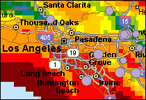
LA
Orange county map (so. cal)
[3
replies]
Friday,
April 8th
Need
Help using the SUM function for County
[1
reply]
Use
MapPoint NA and MapPoint EU in the same application?
[2
replies]
Problem
with map_selectionchange
[3
replies]
DisplayDataMap
method c#
[1
reply]
Deleting
a dataset and shaded area on a map...
[1
reply]
Thursday,
April 7th
Pushpins...
[3
replies]
Where
is the Quit event?
[3
replies]
Coordinates
of regular shape
[1
reply]
Wednesday,
April 6th
Pocket
Streets 2005 - Australian Maps
[1
reply]
MS
Access Mappoint ActiveX
[1
reply]
Ctrl+T
(Data -> Territories...) programatically MapPoint
[3
replies]
Would
like to buy a used copy of MP2002 or S&T2002.
[3
replies]
Tuesday,
April 5th
Synchronous
error
[1
reply]
Solution:
Server busy window after popup context menu.
[6
replies]
Is
Mappoint thread safe
[5
replies]
Monday,
April 4th
Find
center of a polygon
[6
replies]
MapPoint
eu entities and custom data source
[1
reply]
Exporting
"located" data points to excel
[2
replies]
Drawing
/ Zoom
[1
reply]
Sunday,
April 3rd
MapPoint
Road building tool
[1
reply]
Integrating
MapPoint into CRM Web Tool
[1
reply]
Hidden
message
[1
reply]
Saturday,
April 2nd
Saving
current view of map
[2
replies]
Wednesday,
March 30th
Differences
between European Trial and Full NA Editions
[7
replies]
Better
mapping product?
[4
replies]
The
real Da Vinci Code (Map Point Specific)
[3
replies]
Tuesday,
March 29th
Need
a count of occurrences in a zipcode Shaded Area
[1
reply]
How
to place shapes at a screen location?
[2
replies]
License
issue for own Web application
[1
reply]
Monday,
March 28th
Microsoft
MapPoint for Australia
[3
replies]
Determine
if a polyline is closed?
[4
replies]
Find
Airports only?
[1
reply]
HELP!!
Removing City Names and Making Pushpins larger..
[1
reply]
Saturday,
March 26th
Extracting
GPS coordinates from MapPoint
[1
reply]
MapPoint
Automation with C/C++ - Part 1
[2
replies]
Thursday,
March 24th
Miles
[3
replies]
MapPointControl.ocx
[1
reply]
MapPoint
Programming Documentation? Why so little?
[2
replies]
MP
process priority
[2
replies]
Wednesday,
March 23rd
Commerical
traffic restrictions, etc...
[1
reply]
How
does MapPoint compare to other GIS products?
[1
reply]
MapPoint
Development Strategies?
[1
reply]
Exporting
Coordinates, Census Tracts or Other Information
[12
replies]
GeoCountry
-> enum to CString conversion VC++ 7
[2
replies]
Import
coordinate into mappoint 2K4
[1
reply]
How
can I show arrow symbols to indicate direction?
[1
reply]
Tuesday,
March 22nd
Multiple
routes
[2
replies]
Snap
to Road Feature duplicated
[3
replies]
Embedding
MapPoint app into a WinForm?
[7
replies]
Street
views
[1
reply]
MapPoint
academic license?
[1
reply]
How
can I extend MLS service to other machines
[1
reply]
How
can I hide toolbars and legend panels?
[3
replies]
Monday,
March 21st
C#
samples for MapPoint programming
[3
replies]
University
Campus outlines
[1
reply]
Latitude
and Longitude
[1
reply]
Friday, March
18th
noob
help with counties
[1
reply]
Center
pushin only if out of viewable area??
[4
replies]
Removing
Mappoint label on Mappoint control
[2
replies]
Thursday,
March 17th
Getting
names of streets around a location
[3
replies]
MapPoint
2004 USA installation problem
[3
replies]
Import
roads into MapPoint 2004 Europe
[4
replies]
PLEASE
HELP!!!!
[1
reply]
Wednesday,
March 16th
DisplayDatamap
and ArrayOfCustomValues
[3
replies]
Blocking
the moce of a pushpin
[2
replies]
Adding
new symbol to map
[1
reply]
Mappoint
active x control crashes at random points
[4
replies]
Using
a mappoint image
[2
replies]
Display
questions
[1
reply]
Tuesday,
March 15th
Calculate
route
[4
replies]
Hiding
city names
[4
replies]
Finding
a geoevent in a polygon
[1
reply]
Monday,
March 14th
Route
Scheduling Software (HELP!)
[3
replies]
AfterViewChange
event and Map.Location
[6
replies]
Multiple
zooms and pans
[5
replies]
Size
of pushpin's note
[5
replies]
Integrating
Mappoint into my home grown application
[1
reply]
Sunday,
March 13th
Override
a route
[1
reply]
Friday,
March 11th
Is
MapPoint the right software product for me???
[2
replies]
Show
stops with address in text box
[3
replies]
Critical
Method Question
[1
reply]
Drag
and Drop with mappoint
[1
reply]
Opening
an application from hyperlink of Pushpin
[4
replies]
Thursday,
March 10th
List
of Available Symbols
[17
replies]
Change
Symbols @ runtime
[2
replies]
cant
create a Puspin-Object
[5
replies]
Re:
Keyboard control in mappoint activex control
[1
reply]
Wednesday,
March 9th
Moving
groups of pushpins to front
[2
replies]
Adding
Pushpin
[5
replies]
More
routes in the same map
[1
reply]
How
I can Disable the summary of map when I Draw a Route
[1
reply]
Tuesday,
March 8th
Does
anybody know how a can place my custom balloons
[1
reply]
Highlight
property
[1
reply]
Changing
Multiple Pushpins Simultaneously In Pocket Streets
[1
reply]
Monday,
March 7th
Noobs
1st post. I have yellow tags on my...
[2
replies]
Thick
streets vs. spindly streets - how?
[1
reply]
Sunday,
March 6th
Map
in C#
[5
replies]
Can
I use MP for this and how hard will it be to learn?
[1
reply]
Friday,
March 4th
Referencing
Both NA and Europe in .NET
[4
replies]
Pulling
USA demographics from mappoint
[2
replies]
DataSet.Paste:
Exception from HRESULT: 0x80040E04 (vb.NET)
[2
replies]
Mappoint
Newbie
[1
reply]
Extract
the best route
[17
replies]
Thursday,
March 3rd
don't
delete pushpin
[1
reply]
Need
to see County lines in Zip territory mode...
[1
reply]
Get
PushPin
[1
reply]
Does
Anyone Else Use Mappoint In A Terminal Services Env?
[2
replies]
Wednesday,
March 2nd
MapPoint
2005??
[4
replies]
How
to properly close mappoint control
[1
reply]
Spatial
Data Import + Conversion to Territories
[4
replies]
Tuesday,
March 1st
How
to get alll zip code of one city
[6
replies]
How
to get a PlaceCategory Name?
[1
reply]
Streets
& Trips Maps with MapPoint 2004
[2
replies]
"Failed
to open MapPoint routing construction file"
[3
replies]
Generate
a Route Automatically from Access SQL Data
[1
reply]
C#:
How to find out if MapPoint is still running?
[11
replies]
Monday,
February 28th
How
can I use the Symbols (i.e. car) on a VB form?
[1
reply]
C#
ImportData method help needed
[8
replies]
Sunday,
February 27th
Laucnhing
Mappoint via another application
[1
reply]
Developers-for-hire
[1
reply]
MapPoint
2004 - Get GPS Coordinate from addresses in batch
[1
reply]
Final
Year Project
[2
replies]
Saturday,
February 26th
Getting
the lat/long from MapPoint ActiveX
[1
reply]
Friday,
February 25th
New
to Mappoint...Qustions on Lat/Long
[6
replies]
Recordet
operation speed
[2
replies]
New
to MapPoint... Having some questions...
[2
replies]
Thursday,
February 24th
Client-Side
Point Conversion
[2
replies]
Exclusive
Drivetime zones
[1
reply]
MapPoint
Library Redistribution
[1
reply]
Wednesday,
February 23rd
Hub
and Spoke / Visual Display of Routes
[3
replies]
MapPoint
2004 and Excel 2002
[2
replies]
Changing
symbols of multiple pushpins.
[5
replies]
Catch
mappoint events using C++ (without MFC...)
[8
replies]
java
issue
[1
reply]
Tuesday,
February 22nd
How
to disable the save dialog box
[3
replies]
Mappoint,
SQL, and Access
[2
replies]
C#:
How to find out if MapPoint is installed?
[2
replies]
Win2000
Server+Infragistics Toolbar+Mappoint = problem?
[2
replies]
Displaying
two diffrent routes
[2
replies]
Changing
the color of route
[1
reply]
Coding
in MP.
[1
reply]
Long
Lats of Way points.
[1
reply]
Monday,
February 21st
Maps
of Brazil
[1
reply]
Label
Waypoints
[8
replies]
Sunday,
February 20th
Switching
from Staging to Production
[1
reply]
Saturday,
February 19th
MapPoint-Europe
VB6 software
[7
replies]
Friday,
February 18th
Sanity
Check Please......Pushpin help
[2
replies]
Thursday,
February 17th
Is
an address within an area?
[4
replies]
Error
"overflow execution stack" while readinq a
[5
replies]
Wednesday,
February 16th
Managing
Toolbars (In .Net)
[3
replies]
S&T
2005 does not find com1
[2
replies]
Link
data to Goldmine
[1
reply]
Format
balloon shape
[1
reply]
Displaying
several points on one map using C#
[3
replies]
Draw
a route between two LONGS LATS
[1
reply]
Tuesday,
February 15th
Zipcodes
[1
reply]
Creating
an Add-in in VS .net
[2
replies]
MapPoint
addin
[5
replies]
Exporting
data
[3
replies]
PushPin
not set on correct location but shown with line
[1
reply]
Monday,
February 14th
Map
Route with other location
[1
reply]
Delphi
mp2k4 findaddress
[4
replies]
CopyMap
in DLL
[2
replies]
Cannot
create ActiveX component.
[1
reply]
Map
layout is web service as in MapPoint 2004 Europe
[3
replies]
Sunday,
February 13th
MapOptions.Style
in WebApp like MapPoint 2004 Europe?
[2
replies]
Microsoft
Great Plains, Navision, Solomon, CRM, RMS - review
[3
replies]
Friday,
February 11th
Formation
MapPoint
[1
reply]
Thursday,
February 10th
Drawing
Radio Station Contours (ASCII lat/long list)
[4
replies]
Borland
C++ Builder : Using Mappoint over olecontainer
[2
replies]
"The
parameter is incorrect"
[9
replies]
Nextel
i530 and GPS
[4
replies]
New
streets?
[6
replies]
Disabling
the Save Pop up when application closes
[2
replies]
Selecting
and deleting the push pin
[1
reply]
Wednesday,
February 9th
Save
/ restore map settings
[1
reply]
Find
3 closest matches
[5
replies]
Tuesday,
February 8th
Control
Height and Width of images saved using MapPoint lib
[3
replies]
MP
Web Services image quality, can we improve image quality?
[1
reply]
Additional posts
and topics since the last newsletter summary can be found in the MapPoint
forums. Search by using the
forum's search
functionality or the google
search link at the bottom of
each forum page.
Previous issues of
the MP2Kmag Update are available in
the newsletter
archive.
|
| Copyright
1999-2005 MP2K Magazine |
To unsubscribe from
this newsletter send a blank email to newsletter@mp2kmag.com
with UNSUBSCRIBE in the subject line.
To subscribe to this newsletter and ensure you receive future issues
on your preferred e-mail address
send a blank e-mail to newsletter-subscribe@mp2kmag.com.
Please forward this newsletter to anyone who would be interested!
|