Click here to view this issue online            
Click here!
 Thursday - July 21, 2005
What's New at MP2K Magazine 
Welcome to another issue of the MP2Kmag Update. MapPoint has been in the news quite a lot in the last few months. First, the MapPoint Location Server became available in the U.S. with Sprint back in May. Later that month, Bill Gates gave a demonstration of Virtual Earth at "D" Conference. And late last month, MSN launched Local Search. In the meantime, Microsoft also licensed imagery from two companies, Pictometry and ORBIMAGE for use with Virtual Earth, the MapPoint Desktop and MapPoint Web Service teams moved out from under the the Mobile and Embedded Devices Group (MED) to MSN (the MLS folks are still a part of MED), Richard Marsden released v2.0 of GridImp, CARTASITE released Data2Map, and much more. 

MP2K Magazine is your source for independent news and information about MapPoint technologies and products and is home to the popular web forum for MapPoint users and developers. This month we feature Part II of Sergey Kostrov's series of three articles on Automating MapPoint with C/C++. We also share a conversation with Bob Sullivan of InfoGrow on reselling MapPoint Web Service transactions.

This Issue's Contents at a Glance
 - features: LBS Insight, HUGE European Terrain Map, InfoGrow on Selling MWS Transactions
 - articles: MapPoint Automation with C/C++ Part 2,  Excel User-Defined Functions and MapPoint
 - news: MapPoint Location Server Becomes Available in U.S., Virtual Earth Previewed, MSN Local Search Beta Launched
 - forum: Forum Highlights, Over 11,100 posts and Over 2,050 Registered Users

Happy Mapping and please forward this newsletter to anyone who would be interested!

Eric Frost, Editor
advertisement

SpatialPointMake MapPoint Work Harder for You

Extend MapPoint’s functionality. Add new data layers and menu items. Get expert technical assistance and training. Develop more robust applications. SpatialPoint is staffed with MapPoint and spatial technology experts. We’ve built our business helping customers make the most of MapPoint platforms. From MapPoint 2004 to MapPoint Web Service, from locator applications to decision-support, we’re your source for all matters MapPoint.

Visit www.spatialpoint.com or call toll-free 866.846.5900.


Features

Large MapPoint MugWrite for MP2K Magazine in 2005

If you have a MapPoint presentation, neat programming technique, or would simply like to share the ways in which you are using MapPoint technology or any other ideas, contact us to discuss how we can turn your knowledge into an article and share your experience with the rest of the MapPoint community of users and developers.

Writers often plug their consulting service or other business interest through their bio which appears at the bottom of the article. Others do it for the Large MapPoint Mug (see right!). Whatever the reason, it is rewarding to share and take credit for the knowledge you share with the rest of the community.

European LBS Market

If you have an interest in the LBS Market in Europe, you have probably already heard of the newsletter I am about to recommend. I recently came across LBS Insight, a newsletter "covering news on the Location based services market in Europe. We scan on a regular basis all LBS company’s homepages, magazines, conferences and other forums for news. In addition we interview the industry leaders and give you their visions." Take a look!

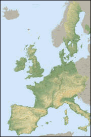
Europe ThumbnailHUGE Europe Terrain View Map

Mike Mattys submitted this map captured through a program he wrote in Visual Basic that stitches together pieces of the map as the map is being scrolled.

This is a terrain view map from Microsoft MapPoint Europe captured at altitude 25,000. The map is part of the whole world capture that can be seen in the pdf file on the home page of www.mattysconsulting.com. Click on the image on the right to view the full jpg image (2MB).

MapPoint Partner Spotlight - Reselling MapPoint Web Service Transactions

Last week we asked Bob Sullivan of InfoGrow some questions about reselling MapPoint Web Service transactions.

How long have you been offering MapPoint Web Service transactions?


We started offering transactions back in January. We started with MapPoint in October 2003 as a Preferred MapPoint Hosting Partner working on the migration of Vicinity sites to the MapPoint platform. 

Can you describe a typical customer?

As Web Service developers ourselves, we recognized a need to provide access to the MapPoint Web Service for sites that use under 1 million transactions a year.  A typical customer has a site application that is in a start-up mode.  The application might be a public site or specific company, where they wish to start out slow and expect the usage to grow.

What is the minimum number of transactions or annual cost that you offer?

The minimum number is 20,000 annual transactions at an investment of $330.

Do you provide help with MWS implementation or consulting for an additional fee?

Yes, we have been building and hosting web service applications for a number of years and have a team of developers that are available to provide support.

What background did your company have with GIS/computer mapping technology before MapPoint? 

InfoGrow has built and hosts a number of MapPoint Web Service public and closed sites for banking, retail, service and manufacturing customers.  Prior to MapPoint we were doing the same with MapInfo’s MapXtreme.  We have over 16 years experience in the GIS/mapping world and are a MapInfo Partner and a Microsoft Certified Partner.

What do you see as your advantage if any vs. others who are selling MWS transactions?

The advantage we offer is our total service approach; first, on our web page, http://www.infogrowcorp.com/mpaccesstrans.html, where we have spelled out all the issues associated with the setup of a MapPoint Web Service account.  Second, our easy to use on-line store, where we provide the ability to purchase the transactions in amounts that meet different user requirements.  Third, we handle the, sometimes confusing process of establishing an account with Microsoft for the customer.

Links for for more information -

    InfoGrow Web Site
    Microsoft Resources for Partners
advertisement
Get more out of MapPoint with CARTASITE Data2Map!

Extend MapPoint with Data2Map
CARTASITE Data2Map delivers the functionality that you've been waiting for. Import and link to data in SQL Server, Oracle, Access, .SHP Files, and MapInfo MID/MIF. Use Data2Map to gain greater control of your pushpins. Display data from multiple map layers simultaneously. Data2Map enables you to do all of the things that you've wanted to do with MapPoint, but couldn't.

Try Data2Map today and see for yourself!

Try Data2Map for free today!
Learn more about Data2Map


Articles

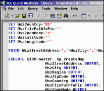
MapPoint Automation MapPoint Automation With C/C++ - Part 2

This is the second of three articles by Sergey Kostrov on automating MapPoint with C/C++. In this installment, Sergey demostrates how to automate MapPoint from a MS SQL Server Extended Stored procedure.

"Microsoft’s Extended Stored procedures extend functionality of the MS SQL Server. An Extended Stored Procedure can be implemented in Dynamic-Link Library ( DLL ) using C/C++ languages and called exactly in the same way as regular Stored procedures are called. Since C/C++ languages are used to create Extended Stored procedures you can do almost everything on the Server side! It means, that actually all COM-objects, installed on your Server computer, and Win32 API are available for you.

In order to automate MapPoint from an Extended Stored procedure you can use C/C++ code from the Part 1 of my article. Also, don’t forget to install MapPoint on the computer where MS SQL Server is already installed!"

  More Full article text Discuss Discuss this story

Texas Route Excel User-Defined Functions and MapPoint

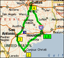
David Hager demonstrates how to incorporate MapPoint functionality into a user-defined Excel function.


"The integration that Microsoft provides between Excel and MapPoint for importing and exporting data provides a powerful method for visual data analysis. As it turns out, there is another way to obtain information from MapPoint to Excel that is not as well-known.

User-defined functions (UDF) are used in Excel worksheets is the same way that native Excel functions are used. The VBA code for an Excel UDF is written in a standard module in the Excel VBE and called by entering the function in a formula in a worksheet cell. In order to incorporate MapPoint automation in an Excel UDF, open the Visual Basic Environment (VBE) by using the Alt-F11 keys. Then, under Tools|References check the Microsoft MapPoint 11.0 Object Library (North America).

A simple example of an Excel UDF that incorporates MapPoint functionality is shown below."

  More Full article text Discuss Discuss this story

Submit an article for publication and receive a free Large MapPoint Mug!

advertisement
Click here!

Get Microsoft MapPoint Today!


MSN Virtual Earth and Local Search News

MSN Virtual Earth News Story Roundup
Links to news stories about MSN Virtual Earth from the Detroit News, XML Journal, Telematics Update, Washington Post, Earth Times, and many more.

MSN Local Search News Story Roundup
Links to news stories about MSN Local Search from the InternetNews, CRM Knowledge Base, Networking Pipeline, Addict 3-D, the Seattle Times, and many more.

Bill Gates Demos Virtual Earth
At “D” Conference in Carlsbad, CA, Microsoft founder Bill Gates presented his vision of MSN Virtual Earth, an exciting new component of Microsoft’s Search vision that gives consumers a deeply immersive search experience where they see what it’s like to be in a location and explore what they can do there.

Microsoft Launches Local Search Beta
MSN released a beta version of a new Local Search service, enabling consumers to quickly retrieve local results from business, residential or local Web sites, often accompanied by informative maps and aerial images. This initial beta release is the first step by MSN® Search toward delivering a broad local search vision, which encompasses geo-local search, mapping technologies, mobile search, local business and residential databases, and local Instant Answers related to news, events, movie times, weather and more.

ORBIMAGE Announces Agreement With Microsoft
ORBIMAGE Holdings Inc. announced that its subsidiary ORBIMAGE Inc. signed an agreement with Microsoft Corp. to supply high resolution global satellite image data for MSN Virtual Earth, a key component of MSN Search. The agreement was unveiled at the O'Reilly Where 2.0 conference in San Francisco during a keynote presentation delivered by Stephen Lawler, general manager of the Microsoft MapPoint business unit.

Web Services Take Differing Paths on Maps
From the International Herald Tribune - "Later in the summer, Microsoft plans to introduce a competing service, Virtual Earth, with software that will enable programmers to use it in similarly creative ways. So far, the uses have been noncommercial. But Yahoo, Google and Microsoft are creating the services in the expectation that they will become a focal point in one of the next significant growth areas in Internet advertising: contextual advertisements tied to specific locations."

Tech Firms Compete to Conquer the Globe
From the Detroit News - "A war of the virtual worlds is starting between search engine company Google Inc. and software maker Microsoft Corp., as the two tech rivals race to bring competing digital versions of planet Earth onto the World Wide Web."

MapPoint News
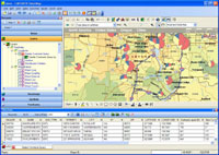
Data2MapData2Map, Empowering Data Integration for MapPoint Users
CARTASITE, a technology solutions provider that empowers the enterprise with time and place intelligence to deliver an immediate operational advantage, today announced the availability of Data2Map, a software application that enhances the power of Microsoft MapPoint 2004. Data2Map fully takes advantage of MapPoint 2004 to deliver enriched data layering capabilities. Data2Map enhances the MapPoint 2004 position of an enterprise mapping platform.

Winwaed Software Technology Releases MileCharter v1.3
vMileCharter v1.3 has just been released. Upgrades are free for all existing registered users of MileCharter. This is considered a maintenance release and has the following changes: - Straight-line distance calculations are speeded up about 10-20 times. - Excel tables with up to 65500 rows are now supported.

MapPoint Add-In for Keyhole
Maphole is a Plug-In for Microsoft MapPoint which will launch and orient Keyhole to view satellite imagery of the currently selected location of MapPoint. Obviously, you must have both Microsoft MapPoint and Keyhole installed on your system for MapHole to work.
GridImpMapping-Tools.com Releases GridImp v2.0
Mapping-Tools.com announced Version 2.0 of their GridImp product for MapPoint. GridImp is designed to plot gridded data in MapPoint - a type of data that cannot normally be plotted in MapPoint. Gridded data can be indexed in various coordinate systems and text file formats. Version 2.0 adds the ability to define custom linear input coordinate systems, and to use UK Ordnance Survey Grid References.

MTI Welcomes Log Creek Timber as Horizon Trucking Customer
Further improving business operations is Horizon Circle of Service, software that automates the dispatch process based on messages sent from the drivers on their QUALCOMM mobile units. With accurate GPS positions and Horizon Mapping, Log Creek staff can see on a MapPoint map where all of their units are.

NAC Signs LBS Deal with Telus
This application is designed for all GPS cellphones to provide address management, locating, navigating, local business searching, cellphone tracking and friends' location monitoring services for more than 30 countries in North America, Europe, South America and Asia-Pacific region (the geographic data is provided by Microsoft MapPoint Web Service).

Action Engine to Support Windows Mobile 5.0
Applications running on the Windows Mobile 5.0 release of the Action Engine Mobile Application Platform will include one-touch integration with a variety of device software, including Microsoft Outlook email, Microsoft MapPoint maps and driving directions, Windows Media Player 10 Mobile and core device functionality, like messaging and telephony.

Switchboard Using MapPoint Web Service
Switchboard announced the launch of its new send-to-mobile capabilities along with enhanced mapping and listings features. The new updates help users quickly access in-depth information on local businesses and include integration with mobile devices, new mapping abilities from Microsoft MapPoint Web Service and enhanced data for movie theatres and ATMs.

Tech Students Win at Microsoft Imagine Cup
From Technique - "Peter Pesti and John Gibby, first and second-year master’s students in Computer Science respectively, developed and submitted a mobile location-based application called mGraffiti. This program allows users to store text messages at any point on a global map covered by Microsoft’s Terra Server, creating virtual “hot spots” that can be accessed and read by other users."

MapPoint Location Server News

Sprint and Microsoft Deliver Real-Time Location Services
In conjunction with the national market launch of Sprint Business Mobility Framework by Sprint, Microsoft Corp. announced the available integration of the Microsoft® MapPoint® Location Server (MLS) with Sprint's network. Sprint becomes the first U.S.-based mobile operator to deliver real-time location services with MLS.

1-800-GOT-JUNK? partners with Sprint and Microsoft
1-800-GOT-JUNK? announced a partnership with Microsoft and Sprint. As part of a new case study, 1-800-GOT-JUNK? will utilize MLS Software into their fleet of junk removal trucks starting May 16, 2005. As one of the fastest growing companies in North America, 1-800-GOT-JUNK? continues to pursue technological advances to better manage their fleet operations in the United States and Canada.

Indus Boosts Field Service Management Capabilities
Indus International announced the expanded field resource optimization capabilities of its Service Suite® software solution via an integration to the Microsoft MapPoint Location Server. This integration will further enhance Indus' robust service management solutions by giving Service Suite users seamless access to Web-based mapping services combined with real-time location data, significantly improving clients' ability to locate, track and manage their mobile assets and mobile workforce.

Cubistix Unveils SecureTrakker
Cubistix announced the national availability of SecureTrakker, a web-based tracking and auditing application that provides real-time location tracking for small and mid-size businesses to cost effectively manage, track, and protect their mobile workforces and fleet assets. SecureTrakker takes advantage of the national availability of the Sprint Business Mobility Framework and Microsoft availability of the Sprint location provider for MapPoint Location Server (MLS).

Sprint Wireless Users Get Location Services
From RedNova - "Sprint recently launched its first location-based wireless service for business users. Called Business Mobility Framework, the service lets users locate and track assets and employees. The carrier is using Microsoft's MapPoint Location Server software to support the service."

Sprint, Microsoft Launch New Vehicle Tracking Capabilities
From Telematics Journal - "Immediately on the heels of today's national market launch of Sprint Business Mobility Framework, Microsoft Corp. announced the available integration of the Microsoft MapPoint Location Server (MLS) and Cubistix unveiled its SecureTrakker."

Location-Based Services Are Finding Their Place
From destinationCRM - "GPS and similar technologies' versatility and power will help the segment see significant growth, despite slow consumer and business adoption."

Ship2Save Uses MapPoint Web Service for Tracking Goods
From Frontline Solutions - "Ship2Save has developed a system for tracking goods in transit using a combination of active and passive RFID, cellular communications, and Global Positioning System (GPS) technology." The RFID-based Unit-in-Transit System "is based on Microsoft's MapPoint Web Service and a Bell Mobility Microsoft MapPoint Location Server. RFID tags on individual goods or pallets are linked to a UITS system in the truck, and constantly monitored over cellular and GPS technology."
advertisement
Pushpin Tool
Working with pushpins in MapPoint? Get the MapPoint 2004 Pushpin Tool for just $75. The latest features include the ability to export lat/lon coordinates of pushpins to Excel and advanced find Pushpin functionality. Read more and purchase the tool here or go directly to paypal.

Affordable volume licensing now available for organizations wishing to distribute the Pushpin Tool to 5, 10, 20, or 50 or more users.


Forum Highlights

Some notable posts and solutions from the forum over the past few months are listed below. Keep up with the latest news and information about MapPoint by bookmarking the forum and visiting regularly. There are now over 11,100 posts and in the forum and over 2,050 registered users.

Active forum participants are encouraged to claim your free copy of MP2Kmag's Guide to What's New in MapPoint 2004. Also, stay tuned as as plan another edition of the popular What's New Guide for the next version of MapPoint.

Monday, July 18th

MapPoint + network monitor [1 reply]

Friday, July 15th

Type Mismatch in DisplayDataMap [3 replies]

Thursday, July 14th

Can I save Mappoint files as .est so they can be read by ST [1 reply]
Spatial data import [2 replies]

Tuesday, July 12th

Can you use MapPoint for oil/pipeline assets? [1 reply]
Right-Click event on the colored countries [1 reply]
Customizing color combination in ShowData MappingWizard [1 reply]

Monday, July 11th

Getting the coordinates from a freeform shape [5 replies]

Sunday, July 10th

Get country for lat & lon [2 replies]

Thursday, July 7th

Changing the Legend [1 reply]
Probably a stupid question [1 reply]

Wednesday, July 6th

Need help exporting shapes from MapPoint [1 reply]
A single Mappoint-Control for Two Applications [1 reply]

Tuesday, July 5th

Different Color for the intersection of 2 drive time zones [5 replies]

Monday, July 4th

Is there a workaround for the Mappoint Zoom Constraints? [1 reply]
AddLine does not draw lines in right order [3 replies]
Distance Between Single Client & Mulitple Employees [1 reply]
Adding data and displaying territorries [7 replies]

Saturday, July 2nd

MapPoint component ....!!!! [1 reply]
Get direction from point a to point b??? [7 replies]
Garbage collection [4 replies]

Thursday, June 30th

MapPointControl OpenMap filename string length limitation [1 reply]

Wednesday, June 29th

Street detail - Streets/Trips 2005 versus MapPoint 2004 [1 reply]

Tuesday, June 28th

Batch Printing maps [1 reply]

Monday, June 27th

Pushpin software advice please [6 replies]
Another General Question [1 reply]
Open Map Speed [1 reply]

Thursday, June 23rd

How to print maps with longitude and latitude? [2 replies]

Monday, June 20th

Changing a dataset symbol - MapPoint 2002 [1 reply]

Saturday, June 18th

MapPoint Control : Turn-by-turn maps [3 replies]
Problems with creating DVD installation [2 replies]

Friday, June 17th

Asia MapPoint [1 reply]

Thursday, June 16th

Sharing Counties, Map Layers, Possible? [1 reply]
Download Trial Pushpin Tool [3 replies]
Failed to see pushpins in MapPoint 2004 [8 replies]

Wednesday, June 15th

Transparent filling? [4 replies]
HTML, activeX and Javascript - Union method problem [14 replies]

Tuesday, June 14th

Street names: partial matching [6 replies]
Distributing Documents with MapPoint Maps Legal or not legal [3 replies]
Finding the radius of a drawed circle [2 replies]

Monday, June 13th

Laptop and GPS USB receiver ???? [1 reply]

Sunday, June 12th

Adding custom field to a Pushpin [1 reply]

Thursday, June 9th

Fast way to add radius? [1 reply]
http request error 401: unauthorized [1 reply]
Reverse geocoding crash [1 reply]

Wednesday, June 8th

Is there is any way to add roads in MapPoint 2002? [2 replies]
If Mappoint can't do this - any ideas what can? [4 replies]
MapPoint information [1 reply]
Adding/Customizing street on map [1 reply]

Tuesday, June 7th

Can't GetActiveMap from a Thread [1 reply]
MapPoint / Street & Trips / Autoroute [2 replies]
Dataset rendering [3 replies]

Monday, June 6th

Will MapPoint Work for Me [2 replies]
Removing City and State Names from a data map [1 reply]
Subject: Cannot re-install MapPoint after app failure [2 replies]
Export Latitude [1 reply]

Thursday, June 2nd

Plotting MapInfo data in MapPoint [2 replies]
Large prints from MapPoint [2 replies]
Mappoint exception "Call was rejected by callee" [1 reply]
ImportData method ? [2 replies]

Wednesday, June 1st

Multiple Routes in one map [2 replies]
Route and map comparisons [1 reply]
Distance Calculations in Mappoint [2 replies]
MapPoint - Problem : Pushpin is NOT displayed [7 replies]
Re: toolbars in mfc dialog [2 replies]

Tuesday, May 31st

Find uses decimal degrees, way to use decimal mi [1 reply]

Monday, May 30th

MapPoint 2004 Line thickness problem ? [1 reply]

Saturday, May 28th

MapPoint México... [1 reply]

Thursday, May 26th

Traffic Laws [3 replies]
Aquiring and installing Athens MapPoint data? [1 reply]
Stop Users from Deleting or Cutting Pushpins from map view [1 reply]
Multiple Pushpins for One Address, Possible? [6 replies]

Wednesday, May 25th

findNearbySpec... c# problem [3 replies]
How to get balloon to show on mouseover pushpin [1 reply]
Draw multiple routes with MapPoint 2004? [5 replies]
Don't want MapPoint to display the waypoints [1 reply]
MapPoint Europe and mpna82.tlb file [2 replies]

Tuesday, May 24th

c#.. Exception (simple code and method) [2 replies]
Getting road types from out of a street [1 reply]
GetMap(spec) Exception..Pokect Application [5 replies]

Monday, May 23rd

Save map as image [1 reply]

Sunday, May 22nd

Update Questions [1 reply]
FindPlaceResults, I need Help!!! [5 replies]

Friday, May 20th

Exporting zips AND counties AND states according to Territory [1 reply]
Importing raw numbers/data into mappoint [1 reply]
How to add postal code to territories for an excel export ? [3 replies]

Thursday, May 19th

View by zip code [8 replies]
Importing a raw number into mappoint [1 reply]

Wednesday, May 18th

Link Data Wizard Problem (URGENT HELP!!!) [1 reply]

Tuesday, May 17th

Parking MapPoint 2004 icons [1 reply]

Monday, May 16th

Considering MapPoint [1 reply]
Deleting all CShape in CShapes [3 replies]

Friday, May 13th

Chat Program / IRC applet [3 replies]
getAddress(ldouble lat, double lon) (And a question with it) [1 reply]

Thursday, May 12th

Open MapPoint INSIDE browser windows [6 replies]
New to MapPoint - Is it possible to show only ONE state? [2 replies]
Manual Placements and Counties [2 replies]

Wednesday, May 11th

Smooth View Translation from pin to pin [3 replies]
Exporting MapPoint data [1 reply]
Calculate Method [1 reply]

Tuesday, May 10th

MapPoint + COM + PHP [2 replies]
Driving time between each waypoint [1 reply]

Monday, May 9th

Disabling closing of MapPoint? [1 reply]
Change default color of route (VB6) [1 reply]

Sunday, May 8th

Sum of Items within a Radius? [1 reply]

Friday, May 6th

Exporting Lat/Long of State Boundaries to Excel [2 replies]

Thursday, May 5th

Displaying a few simple data numbers per state on a US map [1 reply]

Wednesday, May 4th

Batch export in MapPoint 2004 [1 reply]
Clearing all pushpin [4 replies]
Lat Lon problem URGENT HELP [1 reply]

Tuesday, May 3rd

Multiple Addresses [1 reply]
How do you add records to a dataset [1 reply]

Monday, May 2nd

How to get Altitude using Latitude , Longitude [1 reply]

Sunday, May 1st

Getting Census Tract from a pushpin [2 replies]
GPS receiver [1 reply]

Saturday, April 30th

MS Access extracting data from MP 2002 [1 reply]
Multiple tracking [1 reply]

Friday, April 29th

Where can I get MapPoint test version? [2 replies]
Nobody knows the answer? How to retrieve the name of country [1 reply]

Thursday, April 28th

Street address from lat/lon... VB style [3 replies]
Map Point Failed to Load - might just be a headache [1 reply]
Pushpins [1 reply]
Closing: MapPoint process still running [4 replies]

Wednesday, April 27th

Need Zips for PR [1 reply]
Showing multiple routes [2 replies]
Problem with 'Save Map' Dialogue box. [3 replies]

Tuesday, April 26th

New DataSource Unavailable? [1 reply]
Problem with ParseStreetAddress [3 replies]
MapPoint for sales [1 reply]
Northern Ireland & Channel Islands Postcodes not Recognized [2 replies]
ToolBars Color [9 replies]
Street Names etc... [1 reply]
Return Pushpin Symbol [1 reply]
 

Additional posts and topics since the last newsletter summary can be found in the MapPoint forums. Search by using the forum's search functionality or the google search link at the bottom of each forum page.

Previous issues of the MP2Kmag Update are available in the newsletter archive.

Copyright 1999-2005 MP2K Magazine

To unsubscribe from this newsletter send a blank email to newsletter@mp2kmag.com with UNSUBSCRIBE in the subject line.
To subscribe to this newsletter and ensure you receive future issues on your preferred e-mail address send a blank e-mail to newsletter-subscribe@mp2kmag.com. Please forward this newsletter to anyone who would be interested!