Welcome
to this special edition
of the MP2Kmag
Update. In this edition we focus on the latest updates to the MapPoint
Web Service - MWS 4.0. Regular coverage of MapPoint news will continue
next month.
MP2K Magazine is your source for independent news and information about
MapPoint technologies and products and is home to the popular web forum
for MapPoint users and developers. In this issue we feature a
conversation about the MapPoint Web Service with David Klein of
SpatialPoint. There are two articles, a FAQ and Fact Sheet about MWS
4.0 and we share information about the new features and expanded
regional coverage of MWS.
This Issue's Contents at a Glance
- features:
MapPoint Web Service 4.0 Regional Coverage, New Features in MWS 4.0, MapPoint Partner Spotlight - SpatialPoint
- articles:
MWS 4.0 - Frequently Asked Questions, MapPoint Web Service 4.0 Fact Sheet
- news:
MapPoint Web Service 4.0 and MSN Virtual Earth News
- forum:
Forum Highlights, Almost 12,000 posts
and Over 2,300 Registered Users
Happy Mapping and please forward this newsletter to anyone who would be
interested!
|
|
advertisement
Get
more out
of MapPoint with CARTASITE Data2Map!
|
CARTASITE
Data2Map delivers the functionality that you've been waiting
for. Import and link to data in SQL Server, Oracle, Access, .SHP Files,
and MapInfo MID/MIF. Use Data2Map to gain greater control of your
pushpins. Display data from multiple map layers simultaneously.
Data2Map enables you to do all of the things that you've wanted to do
with MapPoint, but couldn't.
Try Data2Map today and see for
yourself!
|
|
|
|
Features
 MapPoint Web
Service 4.0 Regional Coverage MapPoint Web
Service 4.0 Regional Coverage
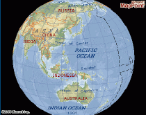
The MapPoint Web Service now provides geographic
street-level detail for all or part of the following countries: Canada,
United States, Mexico, Puerto Rico, Brazil Major cities, Australia,
Hong Kong, New Zealand, Singapore, Taiwan, Andorra, Austria, Belgium,
Czech Republic, Denmark, Finland, France, Gibraltar, Germany, Greece,
Guernsey, Ireland, Isle of Man, Italy, Jersey, Liechtenstein,
Luxembourg, Monaco, Netherlands, Norway, Portugal, San Marino,
Slovakia, Spain, Sweden, Switzerland, United Kingdom, and Vatican City.
With MWS 4.0, Find Address functionality was added for New Zealand, Hong Kong, Singapore, and Taiwan.
For more information see the MapPoint Web Service Regional Coverage page on Microsoft.com.
New Features in MWS 4.0
The MapPoint Web Service added a number of cool new
features with version 4.0 including LineDrive maps which were formerly
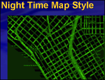
available only on MSN MapPoint. Other new features include a night-time
map style, support for polygons, a feed for real-time traffic
incidents, and better batch geocoding systen and improved find accuracy
settings.
 Chris Pendleton delivered a web cast outlining these and other recently added features in detail which is archived on Livemeeting.
MapPoint
Partner Spotlight - SpatialPoint
Last week we asked David Klein of SpatialPoint some questions about the
MapPoint Web Service and MWS 4.0.
What can you tell us about SpatialPoint? How did the company originate
and what products and services do you provide?
We started SpatialPoint because we saw a significant customer demand
and need for location solutions that deliver business benefits without
the cost and complexity of traditional GIS. We found MapPoint the ideal
platform for meeting the needs of this customer segment. We use
MapPoint to build, host and support Web-based and desktop
solutions.
What advice
would you give to a company looking to add the MapPoint Web Service to
their web site or application and
how can SpatialPoint help?
First I would make sure they understand the full opportunity MapPoint
Web Service presents to them. It’s really an elegant platform
from both a functionality and economic perspective. Because we know the
MapPoint platform inside and out and can draw on our experience with
other customers, we can help a company in many ways. We can build and
host their application, estimate the number of transactions they will
use, help identify and integrate with other business processes that
could benefit from MWS, and provide support and service.
 Describe a
typical client with whom you have helped implement MWS. Can you give an
example of an atypical client or most interesting implementation of MWS
that you have worked on? Describe a
typical client with whom you have helped implement MWS. Can you give an
example of an atypical client or most interesting implementation of MWS
that you have worked on?
A typical application is some type of online locator. We’ve
built many of these for companies such as T-Mobile, M&T Bank,
Prudential Financial and others. Beyond that we’ve had a
number of interesting scenarios, including integrating MapPoint Web
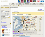
Service into Marriott’s eCommerce reservation system. Another
example is Choice Hotels International. They use our Proximity Analyzer
with MapPoint Web Service to respond to corporate customer RFPs,
quickly showing they have the hotel location and amenities to meet
customers’ needs. Another interesting example is a cell
coverage locator application we’re working on with a major
wireless carrier.
What new
features in MWS 4.0 do you see as being most useful to companies and
application developers?
One of the standout features that is both useful and aesthetic is the
LineDrive feature, which creates
‘back-of-the-napkin’ maps and directions.
They’re very easy to understand and take usability of
Internet-based mapping and directions programs to an entire new level.
Polygon support will open up new application possibilities and on the
nuts and bolts side of things is an improved geocoding interface.
SpatialPoint
is known for its deep mapping/GIS software background and expertise. As
Microsoft adds more features such as polygon overlays directly into the
MWS product which you used to accomplish the SpatialPoint's own
proprietary technology, how do continue to distinguish
yourselves?
The way all successful companies distinguish themselves: by staying
ahead of the curve and anticipating new customer needs. As Microsoft
continues to add more features, there will be a greater need for
experts who know how to take advantage of those features to achieve
business benefit — and to extend those features and
functions. Polygons are a good example. While Microsoft has provided
some support for polygons, SpatialPoint offers customers greater
flexibility in using and managing complex polygons. It really presents
more opportunity for us.
Looking
forward, can you comment on what effect you see Microsoft’s
Virtual Earth technology might have on the MWS product?
I would imagine the line between Virtual Earth and MWS blurring very
rapidly in the near future. If that’s the case,
it’s only good news for customers and for
Microsoft’s own competitive position.
Links for for more information -
SpatialPoint
Web Site
Microsoft
Resources for Partners
 Get
Published in MP2K
Magazine Get
Published in MP2K
Magazine
If you have a MapPoint presentation, neat programming technique, or
would simply like to share the ways in which you are using MapPoint
technology or any other ideas, contact us to discuss how we can turn
your knowledge into
an article and share your experience with the rest of the MapPoint
community of users and developers.
Writers often plug their consulting service or other business interest
through their bio which appears at the bottom of the article. Others do
it for the Large MapPoint Mug (see right!). Whatever the
reason, it is
rewarding to share and take credit for the knowledge you share with the
rest of the community.
|
|
advertisement
|
 Make
MapPoint Work Harder for You Make
MapPoint Work Harder for You
Extend
MapPoint’s functionality. Add new data layers and menu items.
Get
expert technical assistance and training. Develop more robust
applications. SpatialPoint is staffed with MapPoint and spatial
technology experts. We’ve built our business helping
customers
make the most of MapPoint platforms. From MapPoint 2004 to MapPoint Web
Service, from locator applications to decision-support, we’re
your source for all matters MapPoint.
Visit www.spatialpoint.com
or call toll-free
866.846.5900.
|
|
|
Articles
 MWS 4.0 - Frequently Asked Questions MWS 4.0 - Frequently Asked Questions
This
document lists the new features in MWS 4.0 and answers questions about
the licensing model and pricing, the partner program, MapPoint Location
Server, and Virtual Earth.
"What are the new features of MapPoint Web Service version 4.0?
Polygons. The new polygon data source allows MapPoint Web Service
customers to define and render a region on a map. Customers can then
use this region to find relations to other polygons, point data
sources, addresses and specific geographic locations. Common uses of
polygons include defining neighborhoods, delivery areas, cell-phone
coverage and territories. The MapPoint Web Service will offer a
polygon-creation tool and several command-line tools for converting
existing ESRI, MapInfo, Autodesk, Intergraph and GML files to the MWS
polygon file format. Microsoft Corp. is also offering a COM Add-in for
MapPoint 2004 that allows customers to draw their own polygons and save
them to the MWS polygon Extensible Markup Language (XML) file format."
 Full
article text Full
article text  Discuss
this story Discuss
this story
 MapPoint Web Service 4.0 Fact Sheet MapPoint Web Service 4.0 Fact Sheet
The MapPoint Web Service is a programmable XML Web service that
integrates mapping capabilities into business or consumer applications.
It is a location and mapping platform that allows developers to easily
build location-based services into their applications.
"MapPoint Web Service offers enterprises and developers a rich set of
tools they can use to incorporate location-based services into their
applications and business processes. The single application programming
interface (API) provides developers with the following:
- Highly accurate address-finding and geocoding
capabilities for 26 countries and regions in North America, South
America, Europe and Asia
- Finely tuned driving-direction algorithms using blended information from best-in-class data sources
- An extensive point-of-interest (POI) and business listings database with more than 20 million records"
 Full
article text Full
article text  Discuss
this story Discuss
this story
Submit
an article
for publication and
receive a Large
MapPoint Mug!
|
|
advertisement
Find the distances between locations in minutes instead of hours.
Calculates mileage tables and charts using Microsoft MapPoint.
Create the distances between your offices and your customers.
Create atlas-style mileage tables, compute travel times and estimate
costs.
Requires Microsoft MapPoint 2002 or later.
Electronic
Delivery: $60, CD-ROM: $75
|
|
|
MapPoint Web Service 4.0 and Virtual
Earth News
API for Virtual Earth, New Release of
MapPoint Web Service Aim to Get More Eyes on Search Engines
From GISWeekly -
"Developers have been awaiting the day when Microsoft would make
available APIs for both MSN Virtual Earth and MapPoint Web Service 4.0.
That day has now arrived, following closely on the heels of
announcements of new developer tools for both Google Earth and
GoogleMaps."
Microsoft Relies on Developers to Keep
Pace with Google, Yahoo
From ADT Magazine -
Microsoft "also announced MapPoint Web Service 4.0, which is found in
commercial applications as a locator tool. Microsoft expects MapPoint
to help developers create mapping and location-aware applications and
services to help them visualize business processes and data."
MSN Kicks Out API Jams
From InternetNews -
"MSN Virtual Earth beta APIs will be available free for commercial use,
with an option to later add contextual advertising; the MapPoint Web
Service 4.0, which underlies Virtual Earth, will be available for a
fee."
Microsoft Previews New MapPoint Web
Service
From Directions
Magazine - "The MapPoint updates are more of the
same in many ways - new data, a few new features, and new styles for
rendering the maps. The biggest addition from a purely technical GIS
standpoint is support for polygons."
Microsoft Launches APIs For Virtual Earth
From WebProNews -
"Developers can either keep the What/Where search boxes in place in
applications using Virtual Earth maps. Or, for those seeking the
comfort of a service level agreement, billing for transactions through
the API can happen under a current MapPoint Web Service contract."
Microsoft Looks to Developers to Close
Rivals' Search Lead
From TechWeb -
"MapPoint 4.0 enables developers to define customer territories for
services. For example, a call centre for a pizza-delivery service could
break up a city into delivery zones for dispatching drivers, Seinfeld
said. In addition, there are new tools for more customised roadmaps and
the service has been expanded to cover New Zealand, Singapore, Hong
Kong and Thailand."
New MSN APIs To Be Offered
From Search Engine Watch -
"Customers can utilize the MapPoint Web Service as their online mapping
platform with millions of points of interest, mapping coverage for 27
countries, driving directions, numerous map styles, an SLA for
enterprise reliability, and an extranet for uploading custom
information."
PDC - Microsoft Targets Google with
Developer Platform
From IDG News Service -
"Microsoft also will introduce MapPoint Web Service 4.0, which gives
developers customization options for MapPoint that include new mapping
functionality, extended geographic coverage and language support."
|
|
advertisement
|
Forum
Highlights
Some
notable posts and
solutions from the forum over the past few
months are listed below. Keep up with the latest news and information
about MapPoint by bookmarking the forum and visiting regularly. There
are now almost 12,000 posts and in the forum and over 2,300
registered users.
Active forum participants are encouraged to claim
your free copy of MP2Kmag's
Guide to What's New in MapPoint 2004. Also, stay tuned as
as plan another edition of the popular What's New Guide for the next
version of MapPoint.
Friday, October 14th
Use Mappoint ASP.NET whithout mappoint webservice
[1
reply]
Thursday, October 13th
Construction Updates
[2
replies]
MP2004 Link Update Failed -2147190772
[2
replies]
Wednesday, October 12th
Converting my Windows app. to ASP
[6
replies]
MapPoint doesn't work as Window Service
[5
replies]
A simple map with a pushpin on click
[1
reply]
Tuesday, October 11th
Printing pins that are highlighted in optimized order
[2
replies]
Mapping cities with a population over 50K.
[3
replies]
Saturday, October 8th
I need to change the cursor to a PushPin icon
[5
replies]
Friday, October 7th
Getting Canadian FSAs for Street Addresses
[1
reply]
Problem with ObjectsFromPoint
[3
replies]
Thursday, October 6th
MapPoint pushpins and zip code heavy hitters
[1
reply]
GPS compatability
[2
replies]
Terminal Services Scheduled Task
[1
reply]
Wednesday, October 5th
TOOL/GPS Menu action
[3
replies]
Mass Address/Distance Computation
[2
replies]
Importing multiple maps into Excel
[3
replies]
Removing City Names
[2
replies]
Tuesday, October 4th
Clear/Remove all Pushpins in Mappoint?
[4
replies]
Print only pushpins?
[1
reply]
OLEVariant conversion
[1
reply]
Monday, October 3rd
Adding a PushPin from a Long/Lat position
[2
replies]
Wednesday, September 28th
Creating a selected territories map
[2
replies]
Tuesday, September 27th
Does anyone know is the the zoom level required to show
[2
replies]
Brand new and need help please
[2
replies]
Monday, September 26th
Basic - Zip Code Data (Bubble Diagram)
[1
reply]
How to get latitude and longitude
[3
replies]
Adding Countries to Existing Territories
[1
reply]
MapPoint 2004 new version 2006?
[8
replies]
Sunday, September 25th
Link Data to Excel update MP resets or can't place address
[3
replies]
Saturday, September 24th
Using Mutivariates and Discontinuous Series
[2
replies]
Friday, September 23rd
Maps as web pages
[2
replies]
Defaulting the setting to shortest instead of quickest
[3
replies]
How to get region from a route segment
[1
reply]
Thursday, September 22nd
Display setting for Map
[1
reply]
Problem saving map to html
[1
reply]
Wednesday, September 21st
Exporting Data From Territories
[1
reply]
Get Radius of displayed area while using ViewByScale
[7
replies]
Tuesday, September 20th
How do I Integrate MapPoint with MSAccess
[1
reply]
Distributed desktop application
[1
reply]
Does anyone know of a good site for custom pushpins? (nm)
[1
reply]
MapPoint updates
[1
reply]
Is this possible?
[1
reply]
Monday, September 19th
Query Mappoint Visual Basic 6.0
[2
replies]
Shape coordinates
[3
replies]
How do I update the value of a field in a recordset?
[4
replies]
Saturday, September 17th
Question regarding demographic info
[1
reply]
Friday, September 16th
Enhancing Maps
[1
reply]
Retreiving longitude and latitude
[2
replies]
Thursday, September 15th
Questen about a motor route i have for delivering papers
[1
reply]
How to develop a MapPoint Appication
[1
reply]
Need Help!!!! How to hide Cities and States Labels on Map?
[2
replies]
This recently appeared on MSNBC
[1
reply]
Refresh After A Pushpin Has Been Deleted From the Dataset
[3
replies]
Wednesday, September 14th
Error using ActiveX control in VB 6
[2
replies]
My first VB 6 App with Mappoint 2004
[1
reply]
Question about a motor route I have for delivering papers
[1
reply]
Language Decision
[1
reply]
Can't route and I can't see why.
[3
replies]
Assertion failed error
[2
replies]
Tuesday, September 13th
Automatically Number Pushpin
[3
replies]
Neet Points of Interest database
[5
replies]
Friday, September 9th
How to parse a german address?
[4
replies]
MapPoint hangs when saving map as HTML
[3
replies]
Add more then one field to a newly created pushpin to a data
[1
reply]
Thursday, September 8th
Retrieve Lat/Lon of a ShaddedCircle
[2
replies]
Wednesday, September 7th
Exporting the "show or hide places"
[1
reply]
Load lat/long to display in MapPoint
[1
reply]
Tuesday, September 6th
How to handle FindNearby results in C++
[1
reply]
Exporting to Excel
[2
replies]
Sunday, September 4th
I need it badly.
[1
reply]
Friday, September 2nd
Publish Interactive Map to the Web
[5
replies]
Game with MapPoint
[10
replies]
Thursday, September 1st
Ask for Setup Disc again
[5
replies]
How Can Import Street Names To MapPoint?
[3
replies]
Prevent user from updating pushpin's name and note text
[2
replies]
Automation with C++ (Compile OK but Errors in Linking)
[11
replies]
Wednesday, August 31st
Making map of routes with arrowed lines? (like airline maps)
[1
reply]
Get Lat/Lon of ShadedCircle
[8
replies]
Tuesday, August 30th
Is there any event for when the route is changed?
[3
replies]
Monday, August 29th
Getting a Postal Sector from Latitude and Longitude
[2
replies]
Saturday, August 27th
Optimize multiple stops
[7
replies]
Thursday, August 25th
Huge Number of Drive Times
[3
replies]
Link recordset to waypoints
[3
replies]
Wednesday, August 24th
Adding a permanent Pushpin/Landmark
[1
reply]
Add a newly created Pushpin to Dataset
[1
reply]
Setting up macro in excel to extract lat/long from map point
[2
replies]
Tuesday, August 23rd
Is MapPoint or something else best to map election returns?
[2
replies]
Automate drivetime zones
[5
replies]
Can Anyone Help ? ( vb.NET and MapPoint Europe )
[6
replies]
How to identify failed records in the search?
[2
replies]
Making Maps Uneditable?
[3
replies]
Speed Limit or Street Type
[5
replies]
I don't see a part of the route, please help me
[8
replies]
Monday, August 22nd
Please helpe me! Unable to start Mappoint without Run-CD
[1
reply]
Can't manage to make pushpins invisible/ transparent.....
[20
replies]
Friday, August 19th
How To Filter Pushpins?????
[3
replies]
Help for a delphi program
[13
replies]
Thursday, August 18th
Upgrade Mappoint 2002
[1
reply]
Extracting street names from route Instruction
[1
reply]
Finding Center of Data
[2
replies]
Wednesday, August 17th
Can Streets and Trips open maps created with MapPoint?
[1
reply]
Mexican Maps? Import or Commercial.
[2
replies]
New Plugin for Mappoint + Screen shots
[3
replies]
Is new datasource MapPointNAICS.NA support findnearby Method
[1
reply]
Filtering pushpins..Updating MapPoint by Microsoft Access
[3
replies]
Tuesday, August 16th
Creating New Dataset
[4
replies]
FindPushpin(Name)
[3
replies]
What's the shortest way from one point to another?
[3
replies]
MapPoint failed to load...
[1
reply]
Updates, Overlays and Zips......Help!!
[1
reply]
Monday, August 15th
MapPoint in OleContainer problem //BCB
[3
replies]
Updating map in mapcontrol, through secondary thread
[1
reply]
Returning results from ShowFindDialog
[3
replies]
Sunday, August 14th
Prevent Pushpin/Waypoint deletion
[8
replies]
Saturday, August 13th
Attaching Pictures to MapPoint Records
[2
replies]
Friday, August 12th
Pushpin Selection
[2
replies]
can I get demographic data at 1, 3, and 5 mile radius?
[4
replies]
Thursday, August 11th
UDF in Excel
[2
replies]
Optimizing a lot of stops
[7
replies]
Wednesday, August 10th
Find closest between two sets of addresses?
[2
replies]
Add a bitmap to Mappoint control
[2
replies]
Tuesday, August 9th
Blank Map available?
[1
reply]
Extract National Forests, Parks, and Wilderness Areas?
[1
reply]
Monday, August 8th
Displaying The Route Planner
[4
replies]
Sunday, August 7th
Records that I want to convert to itn files
[4
replies]
Friday, August 5th
MapPoint 2004 and PinsToFile
[7
replies]
Creating a subset of Pushpins from a set of pushpins
[3
replies]
Thursday, August 4th
Change Screen to Night Mode
[3
replies]
Update on Basemaps
[1
reply]
Wednesday, August 3rd
Does an object reside in my Shape or Shape boundaries?
[1
reply]
Tuesday, August 2nd
App to Monitor Real time applications (GPS)
[4
replies]
MapPoint 2004 trial for Australia
[1
reply]
Importdata to shaded areas
[4
replies]
MapPoint WebService Vs MapPoint Location Server
[1
reply]
Monday, August 1st
FindCS WebService SDK Sample
[1
reply]
Do WebService SDK Samples work for Australia
[1
reply]
Hardware requirements
[1
reply]
Sunday, July 31st
How to change default map size?
[1
reply]
Displaying a label with each pushpin
[3
replies]
How can I get the territory code that a pushipin is located
[6
replies]
Saturday, July 30th
Trying to adjust the ActiveMap to display all waypoints
[1
reply]
Zoom IN to show all pushpins in one screen
[3
replies]
Having the driver always be visible
[2
replies]
Wednesday, July 27th
Increase the number of colours in the colour pallet
[1
reply]
Retail locations data
[1
reply]
Tuesday, July 26th
Numbering route pushpins
[5
replies]
Monday, July 25th
GPS simulation
[1
reply]
Saturday, July 23rd
Help with differences between vb6 and vb .Net
[1
reply]
Friday, July 22nd
MapPoint OLE error: "Could not update object"
[1
reply]
Thursday, July 21st
Toobars / Menul
[1
reply]
Using routes and highlighting route
[1
reply]
Customization possible??
[1
reply]
Wednesday, July 20th
Overlay two separate routes
[1
reply]
OLE Delphi 6 Novice
[4
replies]
Tuesday, July 19th
Trying to get the MapPoint.Location at a mouse event
[6
replies]
Getting a MapPoint.Location from a set of coordinates
[2
replies]
Custom symbols
[1
reply]
Monday, July 18th
MapPoint + network monitor
[1
reply]
To know when user click in dataset
[1
reply]
Sunday, July 17th
Send zip code & distance, receive list of zips back?
[1
reply]
Saturday, July 16th
MapPoint Automation with C/C++ - Part 2
[1
reply]
Additional posts
and topics since the last newsletter summary can be found in the MapPoint
forums. Search by using the
forum's search
functionality or the google
search link at the bottom of
each forum page.
Previous issues of
the MP2Kmag Update are available in
the newsletter
archive.
|
| Copyright
1999-2005 MP2K Magazine |
To unsubscribe from
this newsletter send a blank email to newsletter@mp2kmag.com
with UNSUBSCRIBE in the subject line.
To subscribe to this newsletter and ensure you receive future issues
on your preferred e-mail address
send a blank e-mail to newsletter-subscribe@mp2kmag.com.
Please forward this newsletter to anyone who would be interested!
|


 Chris Pendleton delivered a web cast outlining these and other recently added features in detail which is archived on


