Click here to view this issue online
Click here!
 Thursday, September 30, 2004
What's New at MP2K Magazine 
Welcome to another issue of the MP2Kmag Update. MP2K Magazine is your source for independent news and information about MapPoint technologies and products and is home to the popular web forum for MapPoint users and developers. I hope you have had a wonderful summer, meanwhile the MapPoint team has been busy and there is a lot of news to share.

In this issue we feature an article from Richard Marsden showing how to display Earthquake Hazard data in MapPoint using grids, along with the C++ code and links to free USGS data to make your own maps. We are also pleased to share a new column on developing tools and applications with MapPoint and Excel. Finally, take a look at our first Programming Challenge.

Here at MP2Kmag we've been busy with a number of enhancements and upgrades to the site many of which are 'behind-the-scenes' and will improve the stability and future capabilities of the site for application development.

This Issue's Contents at a Glance
 - features: Developing with MapPoint and Excel, Programming Challenge, Site Enhancements, Reader Poll
 - articles: Displaying Earthquake Hazard Data and Recent Earthquakes with MapPoint
 - news: MapPoint Web Service Adds Australia, Grid Imp Tool, Cubistix Products, much more
 - forum: Forum Highlights, Google Search Tool, Over 8,000 posts and 1,400 Registered Users

Happy Mapping and please forward this newsletter to anyone who would be interested!

Eric Frost, Editor, MP2K Magazine
advertisement
MapLinx Pro
MapLinX Pro: The Ultimate Database Tool
for Microsoft MapPoint!

MapLinX Pro is a full-fledged add-on query tool that is seamlessly integrated with MapPoint 2002/2004. This scalable solution is designed to meet the needs of any sized business, whether you are a single proprietary user or part of a large-scale global enterprise it can help you provide extensive business intelligence capabilities including the ability to geocode, query, map and analyze corporate information upon virtual maps with minimum effort.


Features

Developing with MapPoint and Excel - Getting Started

In my experience, Excel is an easy to use black board or sandbox for playing with MapPoint automation/programming and in tandem with output from MapPoint can be a powerful platform for all sorts of geospatial analysis. Perhaps the hardest part for beginners is figuring out where to begin. In this example I will outline the steps involved in setting up a basic macro for launching MapPoint.

First, start Excel and turn on the Visual Basic toolbar by going to Tools | Customize. Using the Control Toolbox, drag a command button to the spreadsheet and name it "Start MapPoint". This will be used for launching your program.

Next, turn on design mode and double-click on your command button. A blank Visual Basic form will open and you should see

Private Sub CommandButton1_Click()

End Sub

Now go to Tools | References and scroll down through the Available References. Check the box next to Microsoft MapPoint 11.0 Object Library (either North America or Europe) and click OK.

Finally, add the additional lines of code exactly as shown below.

Dim oApp As MapPoint.Application

Private Sub CommandButton1_Click()

  Set oApp = CreateObject("MapPoint.Application.NA.11")
  oApp.Visible = True

End Sub

That's it! Close the Visual Basic window, turn off design mode, and click on your button. A new instance of MapPoint should appear. You have already gotten through all the hairy parts and are ready to start automating MapPoint. Just about everything that can be done interactively with MapPoint can now be accomplishing automatically by writing additional lines of code. The programming information section of the help file is a great resource and contains many simple examples.

In the next issue we will use MapPoint to find an address by reading from cells in Excel worksheet. If something is not working right or you need additional help, feel free to post your question in the forum area for this mini-tutorial.

 - Eric Frost

Interested in authoring a "HOW TO" article or series of tutorials about working with MapPoint? Inquire about our submission guidelines.

Large MapPoint MugMapPoint Programming Challenge - October, 2004

Time to show off your MapPoint development skills! Take a look in the forum at this MapPoint Route Optimization anomaly for your chance to receive recognition and win prizes.

Route Optimization in MapPoint will sometimes hang. Often it is due to a bad stop which can be detected and adjusted, but it can also occur even when all the stops check out as OK. Share your solution on the best way to handle these situations.

MP2K Magazine Site Enhancements

MP2Kmag has been fully migrated to a secure installation of Windows Server 2003. The site can run PHP, ASP.NET, Perl, and many other scripting and web application languages. Look for nifty web demos and features in the months ahead.

From the beginning of MP2Kmag in 1999, newsletters have been delivered using ezmlm open source mailing list software. From what I can tell, this project has been quiescent for several years and it's time to move on. This issue is our first attempt at using commercial Windows-based mailing list software. While we hope this is of the behind-the-scenes, unnoticeable variety of 'upgrade', let us know if you notice any problems.

Windows 2003 ServerAds are now being delivered by the latest version of phpAdsNew, a powerful state-of-the-art ad server with flexible reporting capabilities. While unnoticeable by visitors, this will be very much noticed and appreciated by advertisers. Contact us to learn about opportunities for starting your campaign.

Finally - we've been working on a new look for the site which can be previewed in the gallery section. Let us know what you think!

Reader Poll and Drawing - How Do You Use MapPoint?

Tell us for what purpose you use MapPoint for chance to win a Large MapPoint Mug.

For what purpose or applications do you use MapPoint?
 - Fleet / Vehicle Tracking and Management
 - Site Selection or Demographic Analysis
 - Professional Developer / Varied
 - Real Estate
 - Health Care Industry
 - Delivery Routing or Analysis
 - Marketing
 
Click here to respond to the poll and enter the drawing.
advertisement
AutoRoute 2004Microsoft AutoRoute 2004 Clearance - Need European Maps?

In North America and traveling to Europe or have a need for European maps? Our remaining inventory of AutoRoute 2004 is being offered at a clearance price of just $37.99. Free shipping to  North America only. You must click here to take advantage of the special offer.  There will never be a more ideal time to get European maps.MapPoint 2004 European Maps

We also have two copies of MapPoint 2004 European maps available for $299. The European maps are not generally available from retailers in North America and can be very hard to find. Click here to order, first come first serve.


Articles

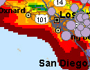
Earthquake MapPlotting Earthquake Hazard Data in MapPoint

This is the first of a two-part article by Richard Marsden showing how to use MapPoint to produce maps of earthquake hazards and to overlay recent earthquakes using data from the USGS. The technique of depicting data using grids can be used in a wide range of environmental and commercial applications.

"Recent earthquakes are plotted as solid circles and the color background displays earthquake hazard as calculated by the US Geological Survey (USGS). The hazard data has been plotted using some custom programming, while the recent earthquake data was prepared with Excel and plotted using MapPoint’s Data Import Wizard. We will look at the earthquake hazard data first."

  More Full article text Discuss Discuss this story

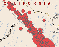
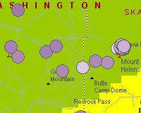
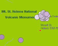
Mapping the Recent Parkfield Earthquake and Mt. St. Helens Activity

Richard Marsden has already prepared a series of additional maps highlighting recent earthquakes. Click on the maps below to read more and see the full-size map.

Parkfield Earthquake Mt. St. Helens Area Mt. St. Helens Dome

Submit an article for publication and receive a free Large MapPoint Mug!


MapPoint News

Microsoft Launches MapPoint Web Service for Australia
Microsoft announced the Australian launch of Microsoft® MapPoint® Web Service 3.5 (MWS) the company’s location and mapping Web service. With the introduction of MWS 3.5 in Australia, businesses and third-party software developers will be able to easily and cost-effectively deploy location-based solutions and applications that incorporate Australian location data.

MapData Sciences To Supply Australian Data For MapPoint
MapData Sciences Pty Ltd (MDS) is to supply Australian mapping data to Microsoft Corporation for use with Microsoft’s mapping solution, MapPoint Web Service 3.5. The MDS data products include RoadNet Comprehensive, RoadNet Routing, Australian Points of Interest, Australian Suburbs and Post Code Boundaries. They will be supplied under a 3-year contract with annual extensions.

Channel Development Strategy in Australia
From ARNnet - Microsoft launched a new developer platform at this year’s TechEd conference and is canvassing partner support. MapPoint has been available in the US and Europe for more than two years. It allows partners to build mapping applications such as online store locators. 

Winwaed Releases Grid Imp Tool for MapPoint
Winwaed Software Technology has released the Grid Imp tool for Microsoft's MapPoint application. Grid Imp plots gridded data in MapPoint, reading from a variety of text formats. Data is indexed using latitude, longitude coordinates (e.g. as used by GPS systems) rather than street addresses.

Color Orthographic Images Made Available Inside Map-In-A-Box
Mapping Solutions LLC announced that its flag ship product Map-In-A-Box for MapInfo Professional has been updated. It now includes seamless access to the high resolution color orthographic aerial images recently made available by Microsoft's TerraServer-USA web portal.

MapPoint to TomTom Navigator Add-in
Blackbit announced the release of a new mappoint add-in: a POI converter that can export all pushpins from multiple datasets to TomTom navigator (using OV2 files).

MapPoint MatchMaker Release 1.0 is Now Available
Darren Gates announced a new MapPoint / Excel application to compute the relative distances and drive times for multiple addresses simultaneously.

Cubistix Announces Release Of CRM Front-End 2.0
Cubistix announced the release of its CRM Front-End 2.0, an intuitive map-based interface for use with the Microsoft Business Solutions CRM system. The incorporation of MapPoint 2004 into CRM Front-End provides users with the ability to create multi-tiered marketing campaigns by segregating their campaigns into geographical containers, plotting customer leads on a map, and exporting maps into Microsoft Word documents.

Cubistix Announces GeoSpatial Case Manager
Cubistix released GeoSpatial Case Manager, a solution developed for child welfare services in response to the unique challenges facing their industry. Cubistix also announced today the results of an in depth case study and proof of concept completed with Florida’s Partnership for Strong Families (PSF).

HarvestGold Releases Sales Planning Process Solution
HarvestGold LP announced the release of the first complete territory-level sales planning solution, the HarvestGold Sales Planning Process. Microsoft's MapPoint, which can be used in conjunction with the HarvestGold software, allows sales managers to plot customer locations and define effective and workable territories.

AirLinkFleet Freedom 3.0 1x and Airlink Pinpoint
Baka Trak-it has successfully completed integration of the Airlink Pinpoint product into an existing telematics client solution. Fleet Freedom's addition of Bell Mobility's 1xrtt network will encompass four different hardware platforms on one screen. This will allow fleet and operations personnel to view devices on different networks and device platforms presented in one user interface from multiple, disparate gateways.

Microsoft and Multimap Sign Agreement
Microsoft and Multimap announced they have signed an agreement to accelerate the delivery of solutions based on the Microsoft® MapPoint® Web Service. As part of a non-exclusive worldwide partnership, Multimap will add Microsoft’s MapPoint Web Service to its service portfolio, providing customers and prospects with a broader range of services.

Submit your press release or news item!

Microsoft and Technology News

Streets & Trips 2005 With GPS LocatorMicrosoft Streets and Trips 2005 With GPS
Streets and Trips 2005 has arrived! This year, Microsoft is also offering a version which bundles a USB GPS unit and cable. The new version includes better GPS support and Pocket Streets for Smartphone. Enhancements include updated map data, more ways to customize your maps, and a GPS pane that displays your heading, speed, and latitude/longitude coordinates.

Small Businesses Fuel Economy With Help From Technology
According to the U.S. Small Business Administration (SBA), small businesses in the United States will produce more than half of all innovations and create 75 percent of all new jobs this year. In recognition of this, Microsoft Corp. announced it is joining other advocates of small business, including the SBA, to show support for small businesses.

Microsoft Backgrounder from the Economist
Microsoft is a software giant: too much of one, say some. The firm's dominance in the operating-systems market first brought scrutiny from the US Department of Justice (DOJ) in 1998. But though Microsoft claims to be a kinder, gentler company these days, the company's strategies for both .NET and Windows XP, its newest operating system, show heavy-handed tactics.

SRC Strengthens Executive Team
SRC LLC announced it has appointed Ed John as Vice President of Sales and Field Operations. Most recently, John served as a principle founder and Managing Director for SpatialPoint LLC, a Microsoft Certified Partner involved in the integration and extension of the Microsoft MapPoint platform.

Mozilla Nips at Microsoft In Market for Web Browsers
From the Wall Street Journal (subscription req.'d) - A gang of Russian cybercriminals has helped accomplish what antitrust regulators couldn't: reduce Microsoft's share of the market for Web browsers, if even just a bit. Millions of computer users this summer tried to avoid an attack by computer hackers in Russia by installing free software from the Mozilla Foundation. July marked the first time since Microsoft vanquished Netscape in the "browser wars" of the late 1990s that the software giant's share of the Web-browser market fell.

Microsoft Business SolutionsMS Releases Microsoft Business Solutions - Great Plains 8.0
Microsoft Business Solutions announced the availability of Microsoft® Business Solutions - Great Plains® 8.0, a cross-industry financial management solution for midmarket segment businesses. Microsoft Great Plains 8.0 will deliver improved usability; richer functionality for distribution, manufacturing and project accounting; greater capabilities through integrations with Microsoft Business Solutions Business Portal 2.5 and Microsoft Office 2003; and improved analytics.

Brazil Has Been Digitized with Universal Addresses
NAC Geographic Products Inc. has announced that Brazil has become the first country in South America that has been completely digitized with Universal Addresses and Natural Area Codes, and made the number of the Universal Address digitized countries to 19: Austria, Belgium, Brazil, Canada, Czech Republic, Denmark, Finland (Uusimaa, Häme, and Pirkanmaa regions), France, Germany, Italy, Luxembourg, The Netherlands, Norway, Portugal, Spain, Sweden, Switzerland, United Kingdom, and United States.
advertisement
Pushpin Tool
Working with pushpins in MapPoint? Get the MapPoint 2004 Pushpin Tool for just $75. The latest features include the ability to export lat/lon coordinates of pushpins to Excel and advanced find Pushpin functionality. Read more and purchase the tool here or go directly to paypal.

Affordable volume licensing now available for organizations wishing to distribute the Pushpin Tool to 5, 10, 20, or 50 or more users.


Forum Highlights

Some notable posts and solutions from the forum over the past few months are listed below. Keep up with the latest news and information about MapPoint by bookmarking the forum and visiting regularly. There are now more than eight thousand posts and in the forum and we are coming up on fifteen hundred registered users.

In addition to the Search function built into the forum near the middle-top of the page, forum members frequently use Google to search the MP2Kmag forum. You can now find a search box at the bottom of the forum to aid in your searches and make your hunt for valuable MapPoint knowledge a little easier.

September

Preventing Display of Menu on Right Click of MapPoint Control [1 reply]
MapPoint Logo Obscuring Pushpin [1 reply]
Point Interpolation [3 replies]
MapPoint Runtime [1 reply]
Creating Territories Programmatically [1 reply]
Polyline Size [4 replies]
How can I open "Show or Hide Places" in program [1 reply]
Conversion from geographic degrees to metres [6 replies]
EULA Question [1 reply]
How do you scroll slowly? [4 replies]
Bad routes using ferries [2 replies]
Getting dataset from user selection [1 reply]
Separating data dots [1 reply]
Questions about MapPoint and MapXtreme [4 replies]
GPS Recomendations [1 reply]
MapPoint or MapXtreme or ??? [1 reply]
Microsoft MapPoint [1 reply]
Any other books to learn MapPoint [3 replies]
Fill the shapes with colors problem [4 replies]
FindAddress Results in c# [1 reply]
Mappoint SDK Samples: 404? [1 reply]
Plotting Earthquake Hazard Data in MapPoint [1 reply]
Drivetimezone in MS C++ [1 reply]
Zip code data [1 reply]
Adding custom pushpin symbol [2 replies]
Hope it can export pushpin points with Lat.&Long [1 reply]
Creating Mileage Charts [1 reply]
What am i doing wrong??? [2 replies]
Sample application in c# [3 replies]
How do I hide a drive time box [1 reply]
Working with demographic data via code [1 reply]
Option strict on issues [1 reply]
vb to c# error question [2 replies]
GetPictureFromObject with C# [1 reply]
Getting Pushpins in front of lines? [1 reply]
Route distance processing speed [2 replies]
Custom context menu [3 replies]
Help installing downloaded Copy of MP NA 2004 [1 reply]
MapPoint For Mac? [2 replies]
MapPoint ActiveX Control Question [2 replies]
First time use - mp04 and excel [1 reply]
Source of street and road data in Mappoint [1 reply]
MapPoint install headache [1 reply]
Problem with locations [3 replies]
Mapping for Nigeria [2 replies]
Using MapPoint to chart soil types <>Beginner<> [1 reply]
Copying map data from Streets & Trips 2005 to Mappoint 2 [2 replies]
Avoid MP std save dialog?¿? [3 replies]
.net and Mappint 2004 [1 reply]
Section 508 compliance for mappoint 2004 [1 reply]
MapPoint 2005/6/7... [1 reply]
MapPoint floating menu [3 replies]
Language setup [2 replies]
Lattitude longitude of cities [2 replies]
Mappoint and a .Net Console App [4 replies]
Selecting Shape Based on Name [1 reply]
Converting Lat/Long to x,y Pixels [2 replies]
Mapping Flow [1 reply]
Creating a new toolbar [3 replies]

August

Seeking Mappoint Answers, in general and specific [3 replies]
Matching Un-matched Records to Zip Code [1 reply]
Creating a map with multiple pushpins [1 reply]
Mileage Chart [3 replies]
ZIP Code Mapping Boundaries for FRANCHISES [1 reply]
COMException [1 reply]
Iran,North Korea, Pakistan, India, etc Road segments [2 replies]
Pocket Streets - help! [3 replies]
Mappoint help [1 reply]
Show ONLY the counties in my territory [1 reply]
Coord Quiz [1 reply]
Printing Individual States...... [1 reply]
Help Working with Hundreds stops [2 replies]
Is Multiple route planning possible. [3 replies]
Proximity Counting [1 reply]
GPS Lat/Lon for my add-in - where is it? [3 replies]
How to use Aerial View (.ECW extensions files) in MapPoint [2 replies]
MapPoint 2004 Trial version [1 reply]
MapPoint Layers [1 reply]
1 mile radius around all pushpins? [1 reply]
Creating a new toolbar - adding functionality [1 reply]
Location coords at known distance & bearing [2 replies]
Naming Shapes [2 replies]
Drawing an Oval Using The Toolbar - QueryCircle? [1 reply]
Populating Pushpin Fields. [3 replies]
Data Associated With Selected Pushpin [1 reply]
Locate Line [1 reply]
VB e MapPoint [1 reply]
Custom pushpins [2 replies]
Creating routes [1 reply]
How to find intersection [1 reply]
Adding Non-Numerical Data [2 replies]
Switching place names off [3 replies]
MapPoint 2004 and ImportTerritories [1 reply]
Does the MapPoint Web Service support ZIP+4? [1 reply]
Detect a pushpin name change. [2 replies]
Extract all zipcodes from MapPoint via C#.NET [1 reply]
Remove Pushpin [1 reply]
How to show only one country? [1 reply]
How to hide waypoints in a route? [1 reply]
interactive with MP internal data [1 reply]
Visual Basic 6.0 [1 reply]
MapPoint 2k4 Newbie question [1 reply]
GPS NavStar [1 reply]
Validating City/State Names [2 replies]
Location Senser [4 replies]
Can you bring with the Location Sensor within a VB program? [1 reply]
Drawing on mappoint object [4 replies]
Need help in entering quaintly against postcode [3 replies]
Addpolyline , Array , Visual Basic and Other languages [2 replies]
Get street name according to Lat/Long [3 replies]
Active-X : Way to determine if pushpin is on diplayed map? [1 reply]

July

Is Measure Distance available in Mappoint Control [2 replies]
Make shorter a GeoBalloonState [2 replies]
Shortest Driving Distance [1 reply]
MapPoint Info [1 reply]
How to keep track of 500+ independent reps [1 reply]
Select a place [1 reply]
Find a start of line [5 replies]
Drawing scribble on mappoint programmatically [1 reply]
VB .NET is so slow! [2 replies]
Problem with LinkData and object QuetyAllRecord [6 replies]
Printing on Custom Paper Sizes (36 x 48) [1 reply]
How do you report MapPoint bugs? [2 replies]
Grabbing GPS coords [4 replies]
Automating MapPoint [3 replies]
Putting MP.Net maps on a Crystal Report [1 reply]
Changing Default View [1 reply]
Excel VBA or VB6 For Speed [3 replies]
Connect pushpins and then remove the symbols? [4 replies]
vb6 to vb.net conversion woes [5 replies]
Schedule Stop Times [6 replies]
Sized Circles are very misleading in MapPoint 2002 [1 reply]
Loss of Functionality? [1 reply]
OT: Streets and trips 2k4 api [1 reply]
New to MapPoint. Can't find any help on this topic [3 replies]
Mid/Mif Donuts Importing [1 reply]
How to add text to a map [1 reply]
Number of pushpins of mappoint [2 replies]
Installation problems in an application that uses Mappoint [1 reply]
Map by county [3 replies]
Set Globe View When Zoomed Out Programmatically? [2 replies]
Quick colour question [2 replies]
Route with highway's gives incorrect result [3 replies]
Only 8 unique data ranges mapped!! I have 2,000, now what? [2 replies]
$$$ Will Pay for A Way to Make a Map $$$ [4 replies]
please help, cheating husband! [6 replies]
Streets and Trips [1 reply]
Converting latitude and longitude to coordinate [1 reply]
Route's screen coordinates [1 reply]
Newbie help; using Excel data to map by COUNT [2 replies]
Problem using MP04 from Outlook 03 [1 reply]
customizing text in balloons using ActiveX control [3 replies]
Pushpin programming question [2 replies]
Persisting a Location object to disk [1 reply]
MapPoint & OS Eastings/Northings (OSGR) [4 replies]
Free .ptm file viewer? [2 replies]
Will Pay $$$ for ASP / ASP.NET $$$ [1 reply]
Problem with dataset.QueryShape Method [1 reply]
Zooming to a fixed number [7 replies]
Address from pushpin [1 reply]
MapPoint 2004 multiple users [1 reply]
adding locations to mappoint [1 reply]
Lat. & Long from pushpins [5 replies]
New to Mappoint and asp.net [2 replies]
Addlines problem [4 replies]
AddShape problem [3 replies]
TEXT [6 replies]
How can I show my current gps location in the ocx control [2 replies]
The requested member of the collection does not exist." [5 replies]
Vertices and VB.Net [2 replies]
MapPoint demo [2 replies]
Will Pay $$$ for Assistance - ASP / VBSCRIPT [1 reply]
MapPoint 2002 Gps update? [6 replies]
EXPORT TERRITORY INFO [1 reply]
Locate nearest polygon shape [1 reply]
Close the map [4 replies]
Reverse Geocoding [3 replies]
A Couple More Hours Wasted - ASP, Starting to Freak Out [1 reply]
Help: convert VB code to Delphi! [2 replies]
Is it possible to use Access [1 reply]
Using ms access with MapPoint resource [1 reply]
Bird site and static maps [1 reply]
How to restrict map area in ActiveX? [1 reply]
How to get selected vertex in a polyline [2 replies]
Save received files [2 replies]
My ContextMenu [1 reply]
An error occurred with MapPoint Location Server - HELP ME! [5 replies]
How to make invisible a pushpin [2 replies]
FindAddress : how to know the point location (long & lat) [1 reply]

June

Geocoding software/engine? [5 replies]
Weather data [1 reply]
MapPointControl and Pushpin [4 replies]
Pushpin [5 replies]
objDataSet = Nothing [1 reply]
Territory zip code capture [1 reply]
How know if a pushpin exist ? [2 replies]
Major problem Territorires and zips export [2 replies]
Editing map types [6 replies]
Is MapPoint What I need? [2 replies]
How to tell if an objects location is visible? [2 replies]
Maps/Routes from Mappoint 2004 to Magellan Sportrack Map [1 reply]
Programatically selecting the Pan or Select tool? [2 replies]
How to create map file ( image_map.gif ) of given fix size.? [2 replies]
Stored Procedure in DataSourceMoniker of ImportData medthod [2 replies]
Highway numbers [1 reply]
Pushpin symbols from imagelist? [2 replies]
Newbie question - Mapping/displaying frequency of events [1 reply]
Exporting pushpin information from territories [1 reply]
Using MapPoint on my website [1 reply]
Other applications [8 replies]
Map loading problem with MappointControl.ocx [1 reply]
Make a road (or 2-3) by calculating the total weight [1 reply]
MS Releases Microsoft Business Solutions - Great Plains 8.0 [1 reply]
Mappoint 2004 installation [1 reply]
Could MapPoint be automated for traffic in a specific city? [2 replies]
Change default road colours [1 reply]
Hard disk install with specific area [1 reply]
GET ME MAPS PLEASE [7 replies]
How to use GetPictureFromObject() or CopyMap() IN C# ??? [1 reply]
Conversion from MP 2002 to MP 2004 changes location lat/lon [2 replies]
No longer able to add new pushpins [1 reply]
Autorute rather than Mappoint [1 reply]
Route Planning (Multiple Point to Points) [1 reply]
Access denied trying to set waypoint.preferredarrival [1 reply]
Multiple destinations from one origin?? [1 reply]
How to show information when saved as web page? [1 reply]
Don't delete my pushpins! [2 replies]
Emulate Radius shape [4 replies]
Route comparison speed [3 replies]
Feature Requests for the Next Version of MapPoint [18 replies]
Icon Size [1 reply]
Panning in ocx [1 reply]
Using MapPoint control in MS Access [1 reply]
Getting current GPS coordinates in VB6 [2 replies]
Newbie- Converting Mappoint 2004 data to Map Info data [5 replies]
Install Problem? [1 reply]
Route to shape [1 reply]
How to stop MapPoint from selecting a wrong address? [1 reply]
Don't want radius shape to increase it's size when I zoom In [1 reply]
Route compute [1 reply]
Mappoint fails calculating the fastest route with avoided zo [4 replies]
Was this a waste? [3 replies]
Newbie- Help with Avg Drive Tim eto 2 Locations [1 reply]
Creating Zip Code Maps (Boundaries) and Unorganized Routing [5 replies]
Demographic info sources [1 reply]
Newbie Question: Locating golf courses around pushpins? [2 replies]
Congressional Districts [2 replies]
Setting default distance unit [1 reply]
Add PushPin by longitude/latidude [2 replies]
Accessing a database directly from MapPoint API [1 reply]
Verifying an address that is missing city info [1 reply]
India? [2 replies]
MS Access and Mappoint ActiveX Control [3 replies]
What Type of Activation Does Mappoint 2004 Have? [3 replies]
Set average driving speed in Mappoint WebService [1 reply]

May

MP2002 and 2004 Installed on Same Machine Problem [10 replies]
Newbie Question [1 reply]
How Do I Use MapPoint To Verify That An Address Is Valid? [2 replies]
Show Pushpins in Front of Lines [1 reply]
Disabling Deleting Pushpin [1 reply]
Error While Connecting MP Webservice : (401)Unauthorized [4 replies]
Info [1 reply]
Can I Program with The "Pushpin Tool"?? [5 replies]
Automatic Bar/Pie Charts (with Data from SQLServer) [3 replies]
Embedding MP within BorlandC++Builder5 [1 reply]
Incorrect Locations? [1 reply]
How to Create Postal Code Boundaries? [6 replies]
Data Import Wizard? [5 replies]
Multiple Routes in 2004 [2 replies]
Points in a Straight line [6 replies]
Pushpins and Fields [1 reply]
Restrictions Web-based GPRS Track & Trace [3 replies]

Previous issues of the MP2Kmag Update are available in the newsletter archive.

Copyright 1999-2004 MP2K Magazine

To unsubscribe from this newsletter send a blank email to newsletter@mp2kmag.com with UNSUBSCRIBE in the subject line.
To subscribe to this newsletter and ensure you receive future issues on your preferred e-mail address send a blank e-mail to newsletter-subscribe@mp2kmag.com. Please forward this newsletter to anyone who would be interested!